ยอดดอยอินทนนท์ · Yot Doi Inthanon
เจ้าของที่นี่? ทำเว็บให้ฟรี · Is this your place? Make its page, free →
ห้องน้ำใกล้สุด · Nearest toilet: ลานจอดเฮลิคอปเตอร์ · 750 ม. ตามถนน · 750 m by road · เดิน ~9 นาที · ~9 min walk · ที่อื่นจากตรงนี้ · more from here
ทัวร์และตั๋วเที่ยวเชียงใหม่ · Klook · Chiang Mai tours & tickets · Klook ลิงก์มีค่าตอบแทน: มดแดงได้ค่าแนะนำเมื่อคุณจองผ่านลิงก์นี้ · Paid link: Mot Dang earns a fee if you book.
เว็บเดิมของที่นี่ · Their earlier website
หน้านี้เปิดไม่ได้แล้ว — เก็บลิงก์ไว้ให้ในคลังแทนเจ้า · This page no longer answers; the archived copy is here instead.- chiang-mai.org/doi-inthanon.html — เครื่องแม่ข่ายมีปัญหา (ตรวจเมื่อ 2026-11-14) · the server reports an error (checked 2026-11-14)
รอบ ๆ ที่นี่ · Around here

ภาพ:Photos: Yoshifumi Iwata (CC BY-SA 4.0) · ผ่าน Wikimedia Commons · via Wikimedia Commons
ธรรมชาติแถวนี้ · Nature nearby
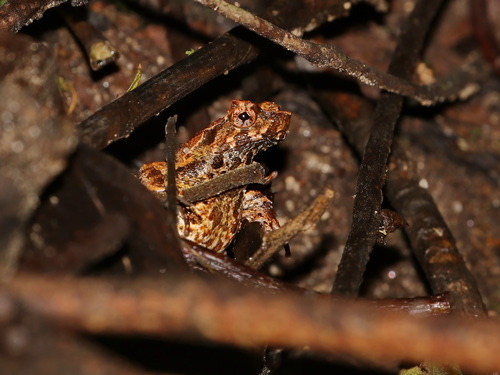 อึ่งกรายอ่างกา · Inthanon Horned Toad350 ม. · 350 m
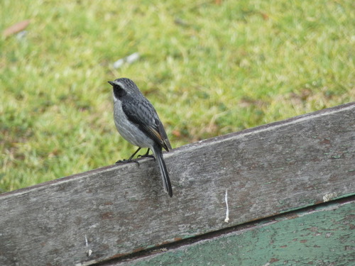 นกยอดหญ้าสีเทา · Grey Bushchat550 ม. · 550 m
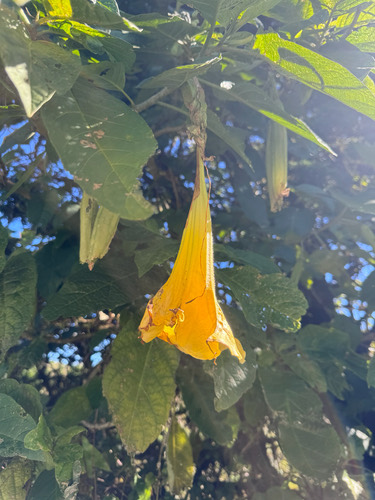 แตรนางฟ้าสีทอง · Golden Angel's Trumpet600 ม. · 600 m
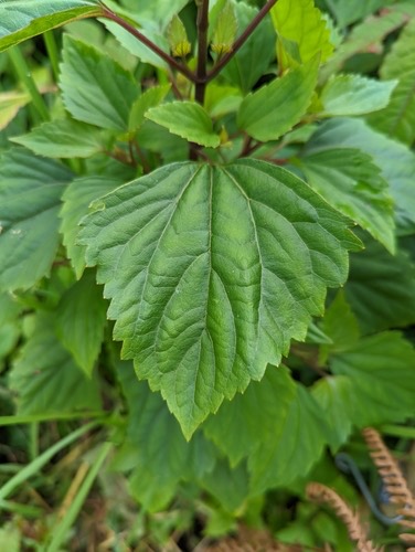 สาบหมา · Crofton Weed600 ม. · 600 m
ภาพ:Photos: Ian Dugdale (CC BY) · luluchouette (CC BY) · PampaSorro (CC BY) · Caleb Catto (CC BY) · ผ่าน iNaturalist · via iNaturalist
ดอย-ภูเขา · Mountain เขตอนุรักษ์-อุทยาน · Nature reserves ต.ช่างเคิ่ง · Changkhoeng (subdistrict) อ.จอมทอง · Chom Thong (district)
- ที่อยู่ · Address
- อำเภอจอมทอง จังหวัดเชียงใหม่ Amphoe Chom Thong · Changwat Chiang Mai
- ตำบล · อำเภอ · District
- ต.ช่างเคิ่ง Tambon Changkhoeng · อ.จอมทอง Amphoe Chom Thong
- แผนที่ · Map
- มดแดง · Mot Dang · OpenStreetMap · Google · Apple · Geo
- รหัสที่ · Place ID
MD-XP3GB- ทิศทาง · Bearings
- ห่างประตูท่าแพ 60 กม. ทางตะวันตกเฉียงใต้ · 60 km south-west of Tha Phae Gate
ย่านจอมทอง-ฮอด-ดอยหล่อ · Chom Thong, Hot & Doi Lo
ชื่อ-ที่อยู่ Overture Maps · CDLA-Permissive-2.0 · Name & address Overture Maps · CDLA-Permissive-2.0 · 2026-10-26