วัดพวกช้าง · Wat Puak Chang
เจ้าของที่นี่? ทำเว็บให้ฟรี · Is this your place? Make its page, free →
≈
ตำแหน่งโดยประมาณ — วงกลมคือช่วงที่เป็นไปได้ · Approximate position — the circle is the range it could be inห้องน้ำใกล้สุด · Nearest toilet: Otop ตำบลหายยา กลุ่มหัตถกรรมชุมชนวัดพวกช้าง · 150 ม. ตามถนน · 150 m by road · เดิน ~2 นาที · ~2 min walk · ที่อื่นจากตรงนี้ · more from here
เว็บเดิมของที่นี่ · Their earlier website
หน้านี้เปิดไม่ได้แล้ว — เก็บลิงก์ไว้ให้ในคลังแทนเจ้า · This page no longer answers; the archived copy is here instead.- lannatalkkhongdee.com/templeDetail.php — โดเมนไม่มีแล้ว (ตรวจเมื่อ 2026-10-16) · the domain is gone (checked 2026-10-16) · ดูฉบับเก็บถาวร 2016-02-19 · see the archived copy, 2016-02-19
รอบ ๆ ที่นี่ · Around here
 แจ่งก๊ะต๊ำ · Katam Corner50 ม. · 50 m
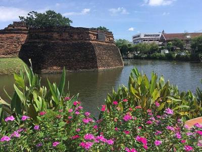 แจ่งก๊ะต๊ำ · Katam Corner100 ม. · 100 m
 Chiang Mai, Thailand: Songkran Festival 2017.100 ม. · 100 m
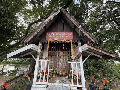 ศาลเจ้าพ่อหลักเมืองแจ่งกระต๊ำ · Chao Pho Chaeng Katam Shrine150 ม. · 150 m
ภาพ:Photos: Christophe95 (CC BY-SA 4.0) · CEphoto, Uwe Aranas (CC BY-SA 4.0) · Chainwit. (CC BY 4.0) · ผ่าน Wikimedia Commons · via Wikimedia Commons


ธรรมชาติแถวนี้ · Nature nearby
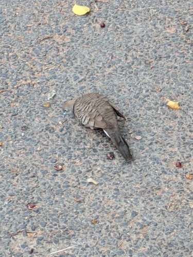 นกเขาชวา · Zebra Dove100 ม. · 100 m
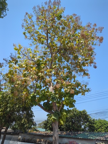 สัก · Teak100 ม. · 100 m
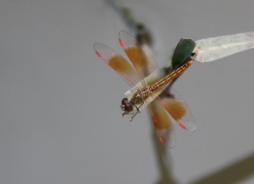 แมลงปอบ้านปีกเปื้อนส้ม · Ditch Jewel150 ม. · 150 m
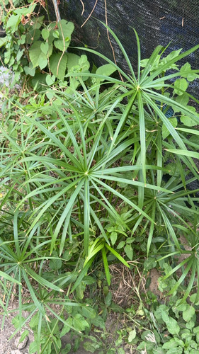 กกรังกา · Umbrella Papyrus300 ม. · 300 m
ภาพ:Photos: engagenosey (CC BY) · jamesne (CC BY) · purperlibel (CC BY-SA) · buriedanimal (CC0) · ผ่าน iNaturalist · via iNaturalist
มหานิกาย · Maha Nikaya วัดราษฎร์ · Wat Rat ต.หายยา · Haiya (subdistrict) วัด · Buddhist temple อ.เมืองเชียงใหม่ · Mueang Chiang Mai (district)
- น้องบี ก๋วยเตี๋ยวไก่ตุ๋นมะระ · Nongbi Kuaitiao Kaitunmara · 10 ม. · 10 m
- Otop ตำบลหายยา กลุ่มหัตถกรรมชุมชนวัดพวกช้าง · 20 ม. · 20 m
- แจ่งก๊ะต๊ำ · Katam Corner · 50 ม. · 50 m
- ต.กลการเชียงใหม่ จำหน่ายอะไหล่รถยนต์ · Ta.klakan Chiang Mai Chamnai Alairathayon · 50 ม. · 50 m
- ขนมจีนน้ำเงี้ยวรสเด็ดหลังวัดพวกช้าง · Khanomchin Nam Ngiao Rotdet Lang Wat Phuakchang · 50 ม. · 50 m
- ชื่ออังกฤษ · English name
- Wat Puak Chang
- ตำบล · อำเภอ · District
- ต.หายยา Tambon Haiya · อ.เมืองเชียงใหม่ Amphoe Mueang Chiang Mai
- ก่อตั้ง · Founded
- พ.ศ. 2040 · 1497 CE
- นิกาย · Nikaya
- มหานิกาย — Maha Nikaya, the larger monastic order
- ประเภทวัด · Standing
- วัดราษฎร์ — a people's temple, not a royal one
- วิสุงคามสีมา · Wisung-khamsima
- ได้รับ — granted · 2516
- รหัสวัด · Temple register code
- 03500103007 ทะเบียนวัด สำนักงานพระพุทธศาสนาแห่งชาติ ฉบับ พ.ศ. ๒๕๖๗ · from the National Office of Buddhism temple register, B.E. 2567 edition
- แผนที่ · Map
- มดแดง · Mot Dang · OpenStreetMap · Google · Apple · Geo
- รหัสที่ · Place ID
MD-ZBBJT- ทิศทาง · Bearings
- นอกเวียง ทางตะวันออกเฉียงใต้ ห่างคูเมือง 120 ม. · ใกล้ประตูเชียงใหม่ 470 ม. · Outside the moat to the south-east, 120 m from the water · 470 m from Chiang Mai Gate
อ่านต่อที่อื่น · Read more elsewhere
OpenStreetMap · 2026-07-21