วัดสันป่าข่อย · Wat San Pa Khoi
เจ้าของที่นี่? ทำเว็บให้ฟรี · Is this your place? Make its page, free →
≈
ตำแหน่งโดยประมาณ — วงกลมคือช่วงที่เป็นไปได้ · Approximate position — the circle is the range it could be inที่แบบนี้มักมีห้องน้ำให้ใช้ · Places like this normally have a toilet · ที่อื่นใกล้ ๆ · others nearby
รอบ ๆ ที่นี่ · Around here
 Chang Moi, Mueang Chiang Mai District, Chiang Mai, Thailand100 ม. · 100 m
 清迈街头100 ม. · 100 m
 Nem nướng as sold in Thailand.300 ม. · 300 m
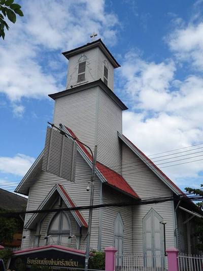 โรงเรียนเชียงใหม่คริสเตียน · The Chiang Mai Christian School300 ม. · 300 m
ภาพ:Photos: mohigan (CC BY-SA 3.0) · 江上清风1961 (CC BY 3.0) · Index Librorum Permissorum (CC0) · Christophe95 (CC BY-SA 4.0) · ผ่าน Wikimedia Commons · via Wikimedia Commons

ธรรมชาติแถวนี้ · Nature nearby
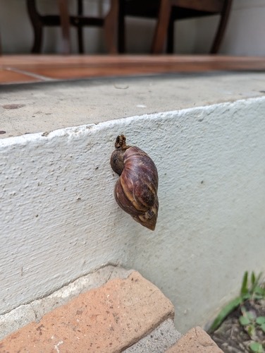 หอยทากยักษ์แอฟริกา · African Giant Snail100 ม. · 100 m
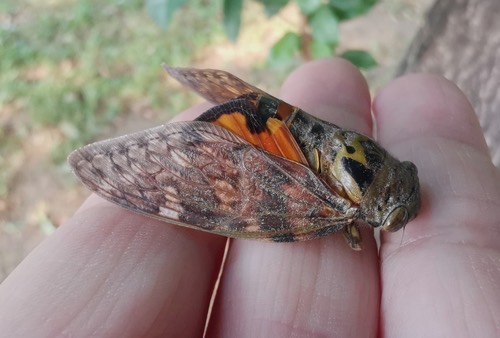 Asianopleura mira300 ม. · 300 m
 หญ้ารังนก · Finger Grass300 ม. · 300 m
 ปลากะมัง · Smith's Barb350 ม. · 350 m
ภาพ:Photos: Jake (CC BY) · Cheryl Stinchcomb (CC BY) · Caleb Catto (CC BY) · ผ่าน iNaturalist · via iNaturalist
มหานิกาย · Maha Nikaya วัดราษฎร์ · Wat Rat ต.วัดเกต · Wat Ket (subdistrict) วัด · Buddhist temple อ.เมืองเชียงใหม่ · Mueang Chiang Mai (district)
- สภอ.ดอยสะเก็ด · A.Doi Saket Police station · 30 ม. · 30 m
- Wat San Pa Koi · 40 ม. · 40 m
- ขนมจีนสันป่าข่อย (เจ้าเก่า) · Khanomchin San Pa Khoi (chaokao) · 60 ม. · 60 m
- ร้านน้องบีม ปังปิ้ง · Ran Nong Bim Pangping · 60 ม. · 60 m
- ดับเพลิงสันป่าข่อย เทศบาลนครเชียงใหม่ · Dapphloeng San Pa Khoi Thetsaban Nakhon Chiang Mai · 60 ม. · 60 m
- ชื่ออังกฤษ · English name
- Wat San Pa Khoi
- ตำบล · อำเภอ · District
- ต.วัดเกต Tambon Wat Ket · อ.เมืองเชียงใหม่ Amphoe Mueang Chiang Mai
- ก่อตั้ง · Founded
- พ.ศ. 2424 · 1881 CE
- นิกาย · Nikaya
- มหานิกาย — Maha Nikaya, the larger monastic order
- ประเภทวัด · Standing
- วัดราษฎร์ — a people's temple, not a royal one
- วิสุงคามสีมา · Wisung-khamsima
- ได้รับ — granted · 2490
- รหัสวัด · Temple register code
- 03500106006 ทะเบียนวัด สำนักงานพระพุทธศาสนาแห่งชาติ ฉบับ พ.ศ. ๒๕๖๗ · from the National Office of Buddhism temple register, B.E. 2567 edition
- แผนที่ · Map
- มดแดง · Mot Dang · OpenStreetMap · Google · Apple · Geo
- รหัสที่ · Place ID
MD-XS08M- ทิศทาง · Bearings
- นอกเวียง ทางตะวันออก ห่างคูเมือง 1.6 กม. · Outside the moat to the east, 1.6 km from the water
ห่างขัวเหล็ก (สะพานจันทร์สมอนุสรณ์) 480 ม. ไปทางตะวันออกเฉียงเหนือ · 480 m north-east of Iron Bridge
ย่านริมปิง-วัดเกต-เจริญราษฎร์ · Riverside & Wat Ket
อ่านต่อที่อื่น · Read more elsewhere
OpenStreetMap · 2026-07-21