วัดสว่างบรรเทิง · Wat Sawang Ban Thoeng
เจ้าของที่นี่? ทำเว็บให้ฟรี · Is this your place? Make its page, free →
≈
ตำแหน่งโดยประมาณ — วงกลมคือช่วงที่เป็นไปได้ · Approximate position — the circle is the range it could be inที่แบบนี้มักมีห้องน้ำให้ใช้ · Places like this normally have a toilet · ที่อื่นใกล้ ๆ · others nearby
รอบ ๆ ที่นี่ · Around here
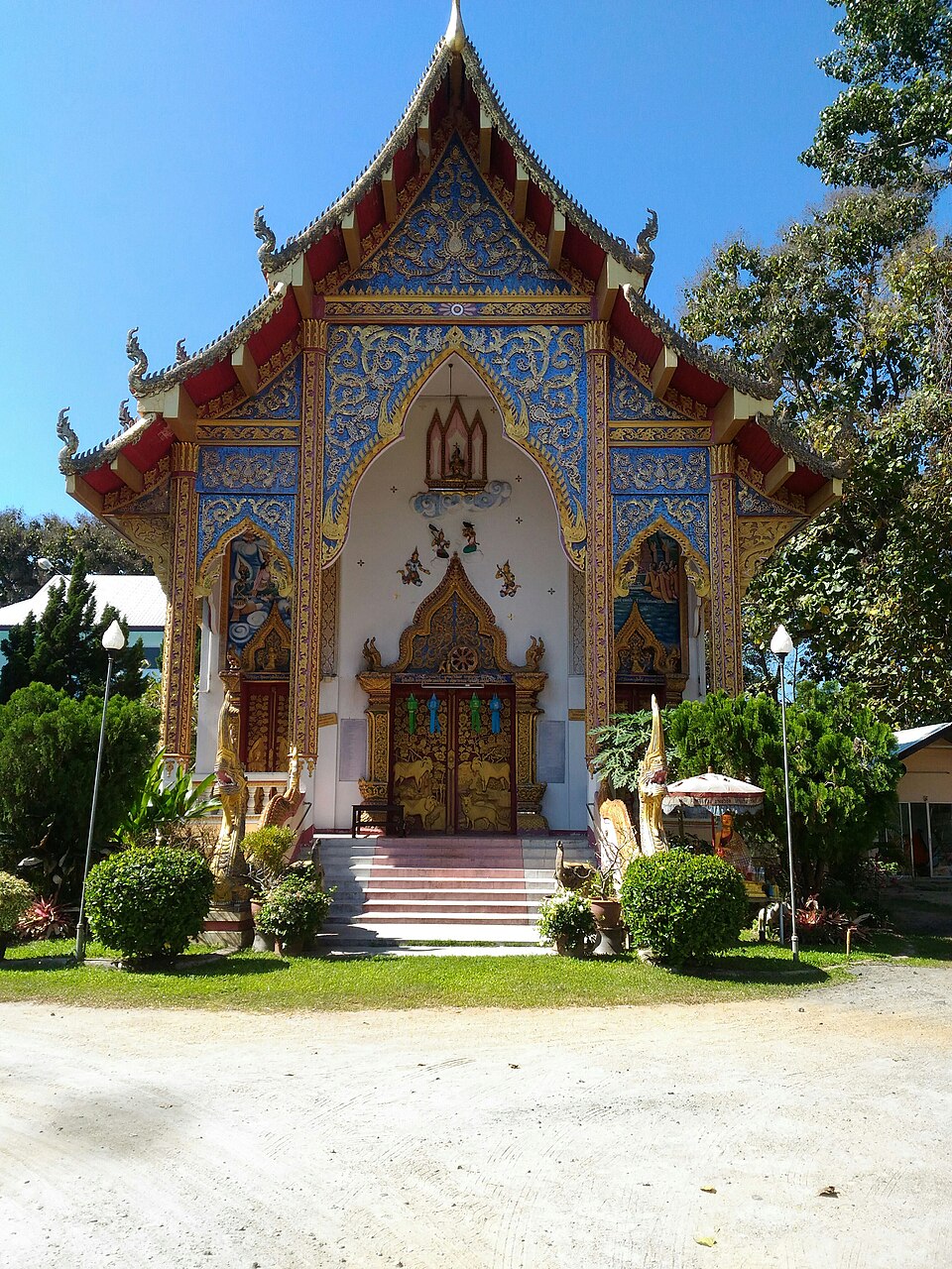
 Tempel aan Highway 107. Boeddhabeelden in de Chedi.ที่นี่ · here
 Tempel aan Highway 107. Boeddhabeelden in de Chedi.ที่นี่ · here
ภาพ:Photos: FredTC (CC BY-SA 4.0) · ผ่าน Wikimedia Commons · via Wikimedia Commons
ต.แม่สา · Mae Sa (subdistrict) มหานิกาย · Maha Nikaya วัดราษฎร์ · Wat Rat วัด · Buddhist temple อ.แม่ริม · Mae Rim (district)
- NIVAS CAFE - นิวาสคาเฟ่ by สหาย’ หลุยส์ · 60 ม. · 60 m
- โรงเรียนบ้านแม่สา · Ban Mae Sa School · 90 ม. · 90 m
- มัก - Mak อาหารเหนือ อาหารอิสาน แม่ริม · 100 ม. · 100 m
- ข้าวซอยลำเจ้า · Khao Soi Lam Chao · 110 ม. · 110 m
- เจ๊ยุ้ยก๋วยเตี๋ยวรสเด็ด · Che Yui Kuaitiao Rotdet · 130 ม. · 130 m
- ชื่ออังกฤษ · English name
- Wat Sawang Ban Thoeng
- ตำบล · อำเภอ · District
- ต.แม่สา Tambon Mae Sa · อ.แม่ริม Amphoe Mae Rim
- ก่อตั้ง · Founded
- พ.ศ. 2385 · 1842 CE
- นิกาย · Nikaya
- มหานิกาย — Maha Nikaya, the larger monastic order
- ประเภทวัด · Standing
- วัดราษฎร์ — a people's temple, not a royal one
- วิสุงคามสีมา · Wisung-khamsima
- ได้รับ — granted · 2493
- รหัสวัด · Temple register code
- 03500709003 ทะเบียนวัด สำนักงานพระพุทธศาสนาแห่งชาติ ฉบับ พ.ศ. ๒๕๖๗ · from the National Office of Buddhism temple register, B.E. 2567 edition
- แผนที่ · Map
- มดแดง · Mot Dang · OpenStreetMap · Google · Apple · Geo
- รหัสที่ · Place ID
MD-2FBSV- ทิศทาง · Bearings
- ห่างประตูท่าแพ 12.4 กม. ทางเหนือ · 12.4 km north of Tha Phae Gate
ย่านแม่ริม · Mae Rim
อ่านต่อที่อื่น · Read more elsewhere

OpenStreetMap · 2026-07-21