อุโมงค์เลี่ยงเมืองสันป่าตอง–หางดง · San Pa Tong–Hang Dong bypass underpass
เจ้าของที่นี่? ทำเว็บให้ฟรี · Is this your place? Make its page, free →
≈
ตำแหน่งโดยประมาณ — วงกลมคือช่วงที่เป็นไปได้ · Approximate position — the circle is the range it could be inห้องน้ำใกล้ที่นี่ · Toilets near here
รอบ ๆ ที่นี่ · Around here
 Master guqin musician Wu Na in Chiang Mai, Thailand250 ม. · 250 m
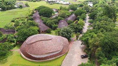 Panyaden International School450 ม. · 450 m
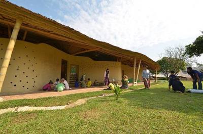 Panyaden International School550 ม. · 550 m
ภาพ:Photos: Takeaway (CC BY-SA 3.0) · Nimromcai (CC BY-SA 4.0) · ผ่าน Wikimedia Commons · via Wikimedia Commons

- บ้านรุ่งอรุณ 3 · Ban Rungarun 3 · 80 ม. · 80 m
- Muban Park 3 · 140 ม. · 140 m
- เดอะไลฟ์สหคลินิก · The Life Sahakhlinik · 160 ม. · 160 m
- สุพัตราคลินิกแพทย์จีน หางดง เชียงใหม่ · Supha Tra Clinic Phaet Chin Hang Dong Chiang Mai · 170 ม. · 170 m
- วีระชัยแมนชั่น · Wira Chai Mansion · 220 ม. · 220 m
- ชื่ออังกฤษ · English name
- San Pa Tong–Hang Dong bypass underpass
- ตำบล · อำเภอ · District
- ต.หางดง Tambon Hang Dong · อ.หางดง Amphoe Hang Dong
- แผนที่ · Map
- มดแดง · Mot Dang · OpenStreetMap · Google · Apple · Geo (โดยประมาณ) · (approximate)
- รหัสที่ · Place ID
MD-RY9AY- ทิศทาง · Bearings
- ห่างประตูท่าแพราว 12 กม. ทางตะวันตกเฉียงใต้ (โดยประมาณ) · about 12 km south-west of Tha Phae Gate (approximate)
ย่านหางดง-สันผักหวาน · Hang Dong
หมุด ±1,000 ม. · pin ±1,000 m
อ่านต่อที่อื่น · Read more elsewhere
Roads of Chiang Mai · 2026-09-21