วัดพญาชมภู · Wat Phaya Chom Phu
เจ้าของที่นี่? ทำเว็บให้ฟรี · Is this your place? Make its page, free →
≈
ตำแหน่งโดยประมาณ — วงกลมคือช่วงที่เป็นไปได้ · Approximate position — the circle is the range it could be inห้องน้ำใกล้สุด · Nearest toilet: Wat Phaya Chomphu · 120 ม. ตามถนน · 120 m by road · เดิน ~1 นาที · ~1 min walk · ที่อื่นจากตรงนี้ · more from here
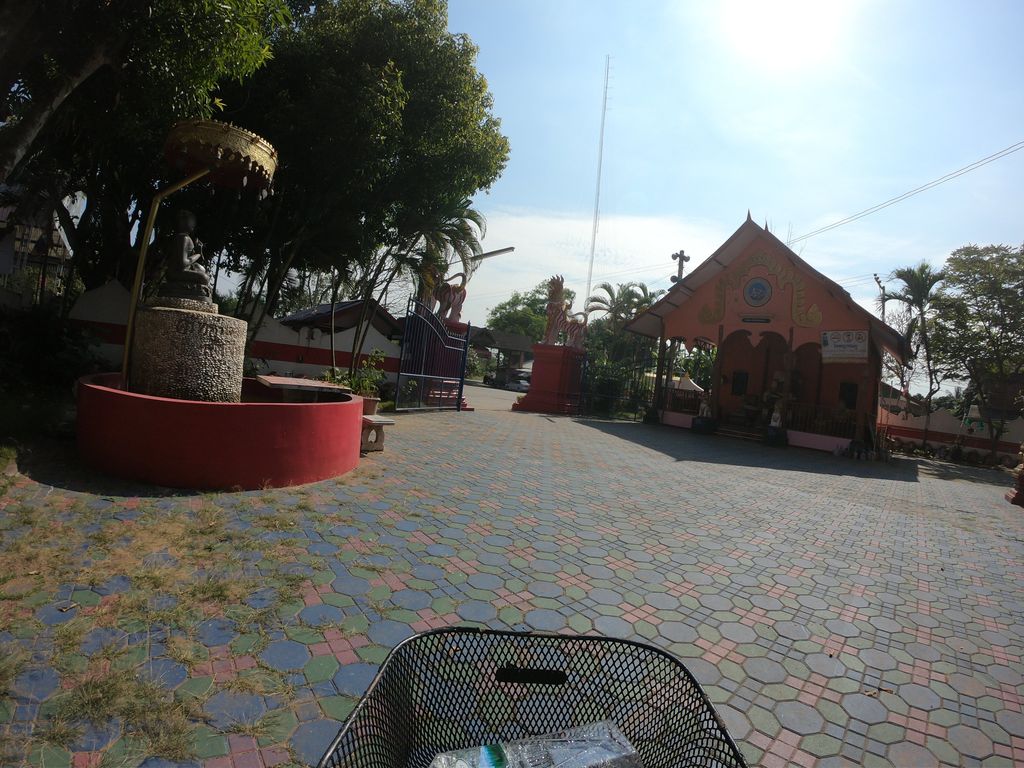
ถ่ายเมื่อ พ.ศ. 2562 (2019) — ตอนนี้หน้าร้านอาจเปลี่ยนไปแล้ว · Taken in 2562 (2019) — the street may have changed since · chanuwath_grab · CC BY-SA 4.0 · Mapillary
ต.ชมภู · Chomphu (subdistrict) ทางหลวงชนบท · Thangluangchanabot มหานิกาย · Maha Nikaya วัดราษฎร์ · Wat Rat วัด · Buddhist temple อ.สารภี · Saraphi (district)
- Wat Phaya Chomphu · 40 ม. · 40 m
- ล้อเกวียนคาเฟ่ · Lokwian Café · 80 ม. · 80 m
- ลาบลุงพัน · Lablungphan · 150 ม. · 150 m
- ลุงเล็กอาหารตามสั่ง · Lung Lek Ahantamsang · 190 ม. · 190 m
- เตี๋ยวต้มตุ๋น · Tiao Tomtun · 230 ม. · 230 m
- ชื่ออังกฤษ · English name
- Wat Phaya Chom Phu
- ที่อยู่ · Address
- หมู่ 2, ถนนทางหลวงชนบท Thanon Thangluangchanabot
- ตำบล · อำเภอ · District
- ต.ชมภู Tambon Chomphu · อ.สารภี Amphoe Saraphi
- ก่อตั้ง · Founded
- พ.ศ. 2346 · 1803 CE
- นิกาย · Nikaya
- มหานิกาย — Maha Nikaya, the larger monastic order
- ประเภทวัด · Standing
- วัดราษฎร์ — a people's temple, not a royal one
- วิสุงคามสีมา · Wisung-khamsima
- ได้รับ — granted · 2350
- รหัสวัด · Temple register code
- 03501903004 ทะเบียนวัด สำนักงานพระพุทธศาสนาแห่งชาติ ฉบับ พ.ศ. ๒๕๖๗ · from the National Office of Buddhism temple register, B.E. 2567 edition
- แผนที่ · Map
- มดแดง · Mot Dang · OpenStreetMap · Google · Apple · Geo
- รหัสที่ · Place ID
MD-8YD20- ทิศทาง · Bearings
- ห่างประตูท่าแพ 11.0 กม. ทางตะวันออกเฉียงใต้ · 11.0 km south-east of Tha Phae Gate
ย่านสันกำแพง · San Kamphaeng
อ่านต่อที่อื่น · Read more elsewhere
OpenStreetMap · 2026-07-21