วิธีทำHow

จากเฟรมสู่หมุดบนแผนที่From a frame to a pin

01

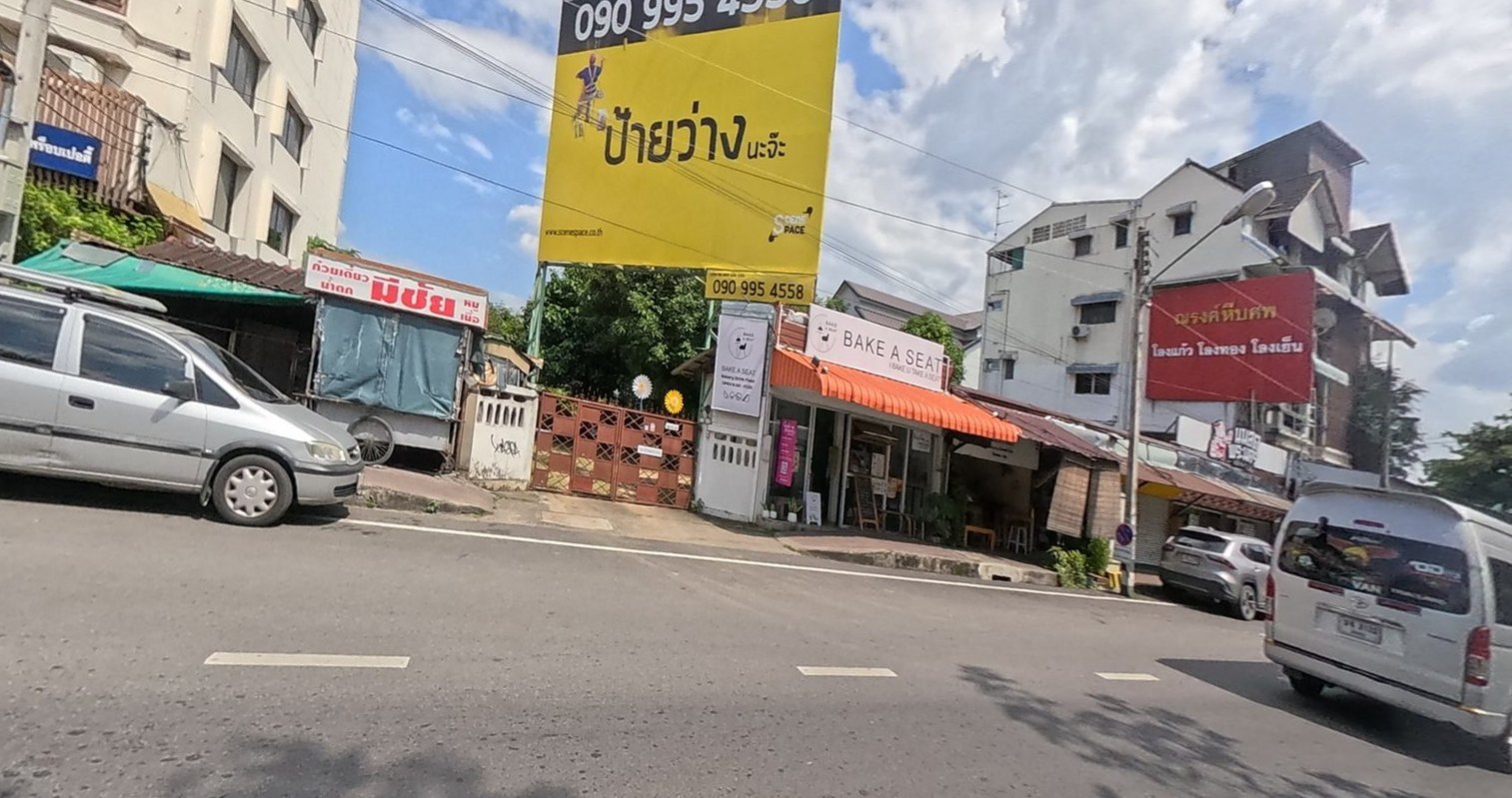
เฟรม 360° ถูกตัดเป็นภาพแบน มองออกข้างทาง

The 360° frame, cut flat, looking at the roadside
02

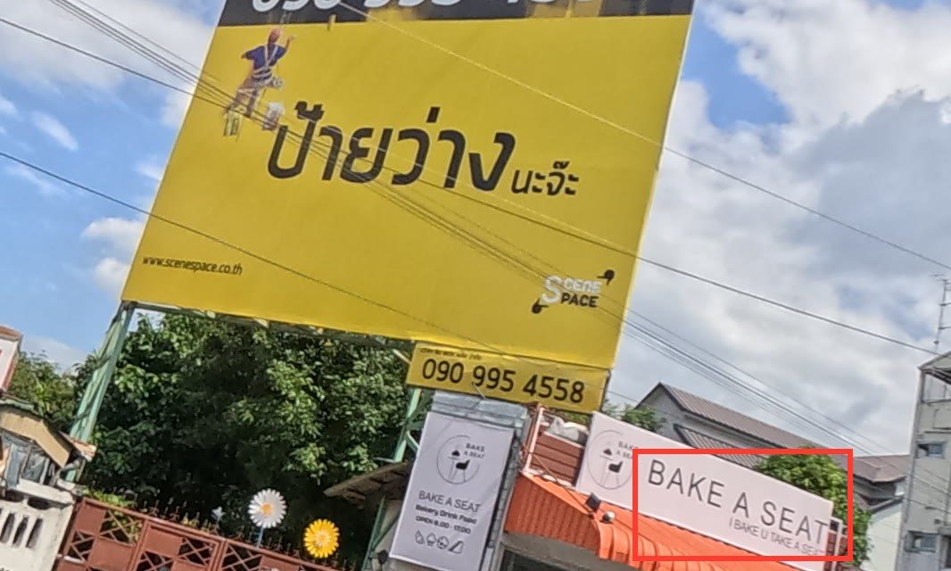
ตัดเป็นช่องเล็ก 16 ช่องต่อเฟรม ให้เครื่องอ่านป้ายที่ความละเอียดเต็ม — กรอบแดงคือที่มันเจอข้อความ

Cut again into 16 tiles a frame so the reader sees signs at full resolution — the red box is where it found text
03

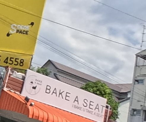
เครื่องอ่านได้ BAKE A SEATE ไม่ตรงกับร้านไหนในมดแดง คนอ่านซ้ำจากภาพ

The machine read BAKE A SEATE, matched nothing in Mot Dang, and a person read the crop again
04

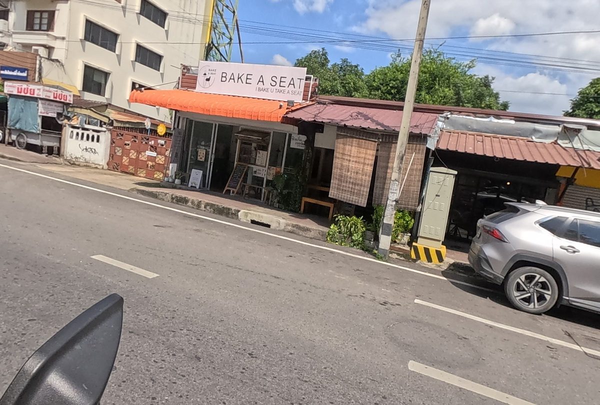
Bake A Seat อยู่ในมดแดงแล้ว พร้อมหมุดและรูป

Bake A Seat is on Mot Dang now, with a pin and this photograph

  1. กล้องอัปโหลดขึ้นคลาวด์ของ GoPro เฟรมเป็นภาพ 360° ขนาด 7680×3840 ส่วนใหญ่มีพิกัด GPSThe camera uploads to GoPro's cloud; each frame is a 7680×3840 360° image, most with a GPS fix.
  2. แต่ละเฟรมถูกตัดเป็น 16 ช่องแบน ให้ Apple Vision อ่านข้อความไทยและอังกฤษEach frame is cut into 16 flat tiles and Apple Vision reads the Thai and English on them.
  3. ข้อความที่ตรงกับชื่อในมดแดงระยะ 120 ม. ยืนยันร้านนั้นA line that matches a Mot Dang name within 120 m confirms that place.
  4. ที่ไม่ตรงกับอะไร คนอ่านจากภาพ ป้ายที่มีชื่อและประเภทบนหน้าร้านเองกลายเป็นรายการใหม่What matches nothing is read again by a person; a name and a trade on the premises' own sign become a new listing.
  5. ภาพที่เผยแพร่ถูกตัดใหม่จากทรงกลม 360° หันไปที่สิ่งที่ถ่าย เบลอหน้าคน แล้วขึ้นหน้าร้าน คลังภาพของมดแดง และหน้าศาลกับภาพเมืองของภาคสนามA published photograph is re-cut from the 360° sphere, aimed at its subject, with faces blurred; it goes onto the place's page, Mot Dang's picture pool, and Field's shrine and scene pages.

โค้ดทั้งหมดบน GitHub →All the code on GitHub →