เมืองและหมู่บ้านแม่แจ่ม
ปลายตะวันออกของทางลัด และประตูหลังสู่ดอยอินทนนท์
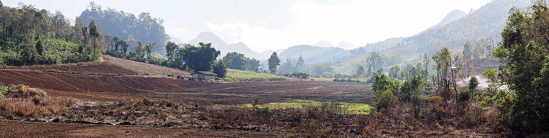 Takeaway · CC BY-SA 3.0
คืออะไร
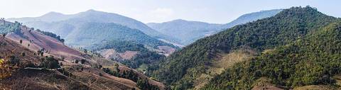
อำเภอหนึ่งของเชียงใหม่ในหุบของตัวเอง เข้าถึงจากวงรอบได้ทางทางหลวง 1263 หรือข้ามเทือกดอยอินทนนท์เท่านั้น
ฉบับยาว
อนุมาน — แม่แจ่มคือเมืองที่เปลี่ยนวงรอบให้เป็นทางเลือก การมาถึงที่นี่จากขุนยวมแปลว่าได้ขี่ 1263 แล้ว และวงรอบถูกตัดครึ่ง ถนนต่อจากนี้ไต่ข้ามฝั่งอินทนนท์แล้วทิ้งตัวลงจอมทองบนทางหลวง 108
ที่นี่เป็นอำเภอทอผ้า และผ้าของที่นี่เป็นเรื่องของตัวเอง ซึ่งโครงการนี้ยังไม่ได้เขียนถึง
ตอนนี้
เล็ก และบริการต่างๆ ก็เล็กตาม เติมน้ำมันที่ขุนยวมก่อนเข้าทางลัด ไม่ใช่ที่นี่หลังออกมา
เกี่ยวข้องกับ
- legทางลัด 1263 — The road that arrives here.
- stopดอยอินทนนท์ — The mountain on the other side.
- townขุนยวม — The other end of the cut.
ถูกอ้างถึงโดย
- legทางลัด 1263 — The eastern end.
- roadทางหลวงแผ่นดินหมายเลข 1088 — Where it starts.
- roadทางหลวงแผ่นดินหมายเลข 1263 — The eastern end.
- stopดอยอินทนนท์ — The town on the back side.
- stopนาขั้นบันไดป่าบงเปียง — The district it is in.
- kitส่งกระเป๋าล่วงหน้า — One of the two towns with nowhere to send it.
แต่ละข้อความมาจากไหน
| Field | Tier | Source | Note |
|---|---|---|---|
| default | cited | Mae Chaem district — Wikipedia (en) | |
| text.story | inference | the riding conclusions are this project's; the geography and history under them are cited | |
| text.today | inference | ||
| text_th | inference | written in Thai by this project, not machine-translated |
แหล่งอ้างอิง
- Mae Chaem district — Wikipedia (en)
- Doi Inthanon — Wikipedia (en)
cited Cited — a named source, linked · harvested Harvested — fetched from an open dataset, with its licence · tradition Tradition — general knowledge of the tradition, hedged · inference Inference — this project's own reasoning from the above · field Field — someone stood there