จุดแวะดอยอินทนนท์
จุดสูงสุดของประเทศไทย และหนาวพอที่จะทำให้คุณประหลาดใจ
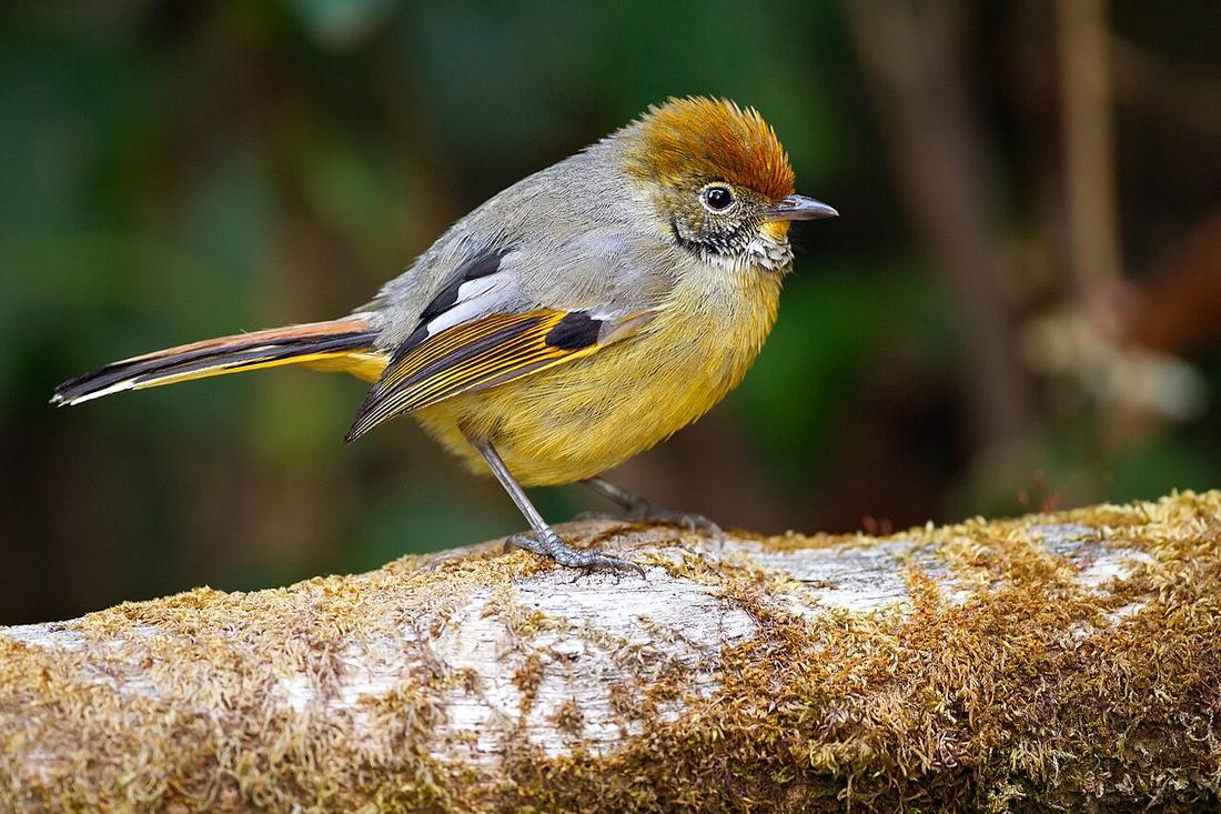 JJ Harrison (https://www.jjharrison.com.au/) · CC BY-SA 3.0
คืออะไร
สูง 2,565 เมตร ในอำเภอจอมทอง ขึ้นได้จากทางหลวง 108 หรือจากแม่แจ่มทางทางหลวง 1088 ไม่ได้อยู่บนวงรอบ แต่แยกจากมันครั้งเดียว
ฉบับยาว
ยอดดอยเป็นจุดสูงสุดของประเทศไทยและอยู่ในเขตอุทยานแห่งชาติ ถนนขึ้นลาดยางตลอดสายและชันเป็นช่วงๆ
อนุมาน — บนเส้นทางนี้มันเป็นการตัดสินใจเรื่องวัน มากกว่าเรื่องภูเขา ถ้าไปตามเข็มมันจะมาถึงตอนท้าย ที่จอมทอง ตอนที่ใกล้ถึงบ้านและเหนื่อยแล้ว ถ้าไปทวนเข็มมันจะมาถึงวันแรก ตอนที่ยังสดแต่ยังมีทางอีกไกล ไม่ว่าทางไหนมันคือหนึ่งวันเต็มถ้าจะทำให้ดี และครึ่งวันแบบเร่งรีบจะได้แค่ลานจอดรถในเมฆ
คนที่มาทางทางลัด 1263 ขึ้นได้จากฝั่งแม่แจ่มทางทางหลวง 1088 ซึ่งเป็นทางที่เงียบกว่า

เกี่ยวข้องกับ
- roadทางหลวงแผ่นดินหมายเลข 1088 — The quiet way up, from Mae Chaem.
- legฮอด – เชียงใหม่ — The leg with the Chom Thong turn on it.
- townแม่แจ่ม — The town on the back side.
ถูกอ้างถึงโดย
- legฮอด – เชียงใหม่ — The turn at Chom Thong, if there is a day left.
- roadทางหลวงแผ่นดินหมายเลข 1088 — What it reaches.
- townแม่แจ่ม — The mountain on the other side.
แต่ละข้อความมาจากไหน
| Field | Tier | Source | Note |
|---|---|---|---|
| default | cited | Doi Inthanon — Wikipedia (en) | |
| text.story | cited | Doi Inthanon — Wikipedia (en) | |
| text_th | inference | written in Thai by this project, not machine-translated |
แหล่งอ้างอิง
- Doi Inthanon — Wikipedia (en)
- Chom Thong — Wikipedia (en)
cited Cited — a named source, linked · harvested Harvested — fetched from an open dataset, with its licence · tradition Tradition — general knowledge of the tradition, hedged · inference Inference — this project's own reasoning from the above · field Field — someone stood there