แผนที่เก่าแผนที่เมือง 2433
แผ่นที่บอกว่าถนนช้างม่อยเพิ่งสร้าง
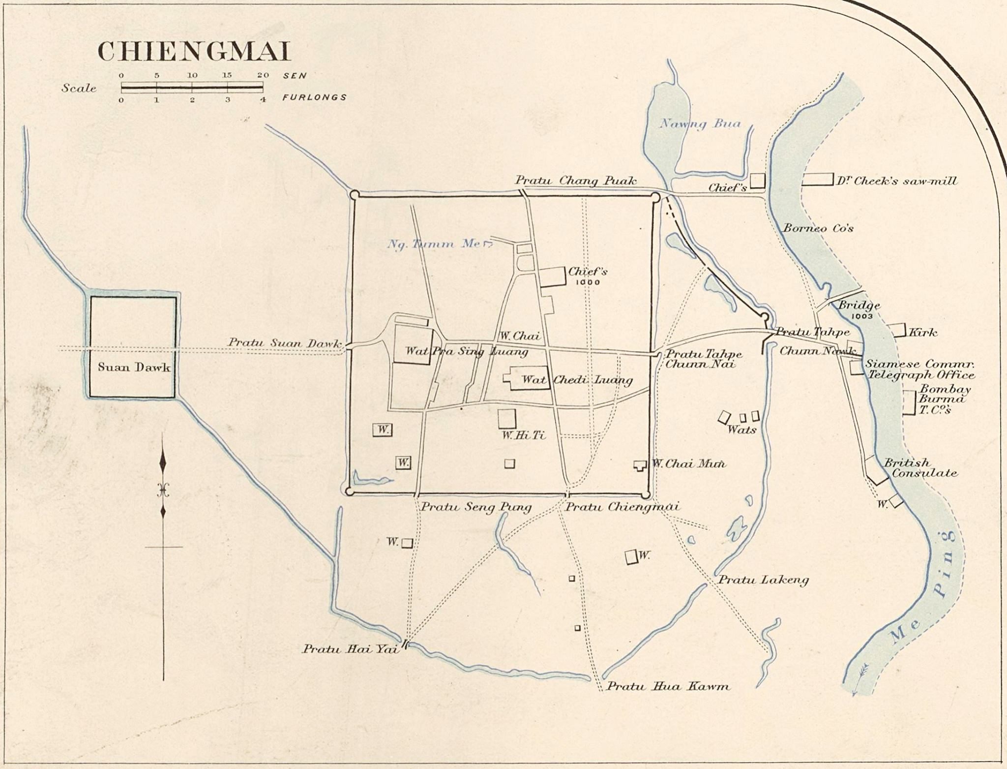 James McCarthy (1853–1919) · Public domain
คืออะไร
แผนที่เมืองภายใต้การสะกดแบบเก่าว่า Chiengmai คำบรรยายของแผ่นเองบอกว่าหน้าวัดหันไปทางตะวันออกบนถนนช้างม่อยที่เพิ่งสร้าง ซึ่งลงวันที่ถนนสายนั้นไว้ราวแผ่นนี้ และยืนยันตำนาน ประตูชั้นนอกและคันดินถูกรื้อระหว่างปี 2453–2458 เพื่อให้ถนนวิ่งตรงไปแม่น้ำ และถนนถูกตัดอยู่แล้วตอนวาดแผ่นนี้
หมายเหตุ
คอมมอนส์ให้เครดิตไฟล์นี้แก่เจมส์ แม็กคาร์ธี นักรังวัดที่ทำแผนที่อาณาจักรให้รัฐบาลสยามในช่วงปีเดียวกัน โครงการนี้ยังไม่เห็นการระบุนั้นยืนยันบนแผ่นเอง
เกี่ยวข้องกับ
- ถนนช้างม่อย The road it dates.
- ประตูช้างม่อย What was removed for it.
- กำแพงดิน The outer wall.
แต่ละข้อความมาจากไหน
| Field | Tier | Source | Note |
|---|---|---|---|
| default | cited | Wikimedia Commons — the map and photograph files, each with its own licence on its file page — Wikimedia Commons | |
| text_th | inference | written in Thai by this project, in the northern register where it fits; not machine-translated |
แหล่งอ้างอิง
- Wikimedia Commons — the map and photograph files, each with its own licence on its file page — Wikimedia Commons
cited Cited — a named source, linked · harvested Harvested — fetched from an open dataset, with its licence · tradition Tradition — general knowledge of the tradition, hedged · inference Inference — this project's own reasoning from the above · field Field — someone stood there