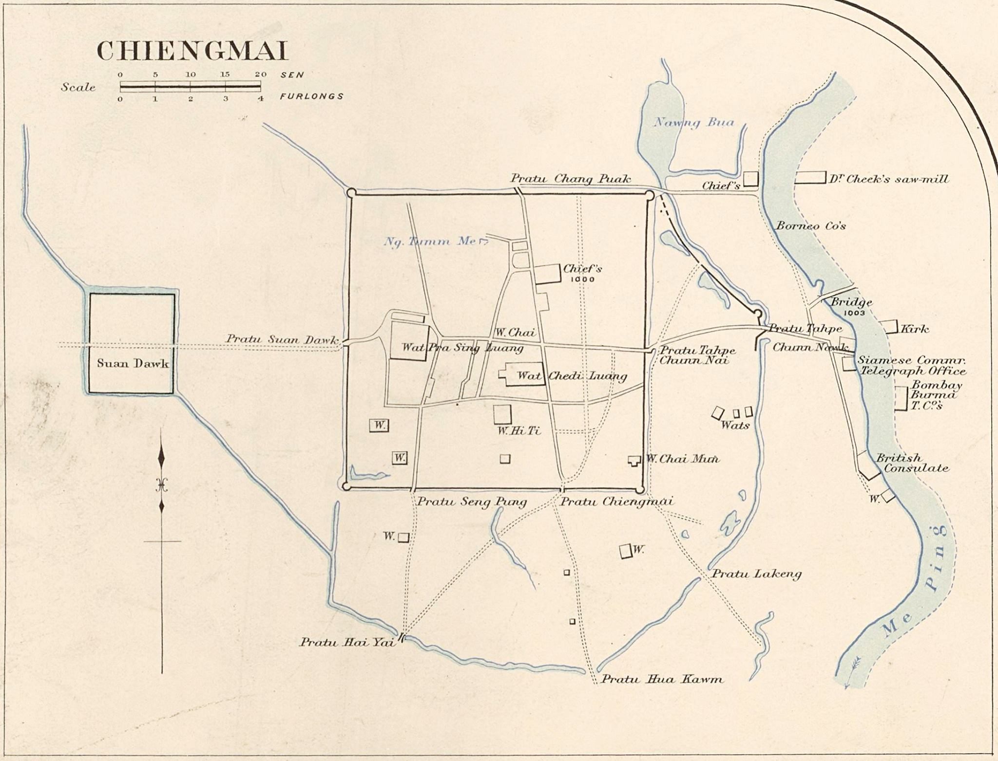
mapThe 1890 city map
แผนที่เมือง 2433
The sheet that names Chang Moi Road as newly built.
 James McCarthy (1853–1919) · Public domain
What it is
A map of the city under the old spelling Chiengmai. Its own caption says a temple front faces east on the newly built Chang Moi Road, which dates that road to about this sheet and corroborates the chronicle: the outer gate and the earth bank came down between 1910 and 1915 so the street could run straight to the river, and the street was already being cut when this was drawn.
Notes
Commons credits the file to James McCarthy, the surveyor who mapped the kingdom for the Siamese government in the same years. This project has not seen that attribution confirmed on the sheet itself.
Connected to
- Chang Moi Road The road it dates.
- Chang Moi Gate What was removed for it.
- Kamphaeng Din, the earthen wall The outer wall.
Where each claim comes from
| Field | Tier | Source | Note |
|---|---|---|---|
| default | cited | Wikimedia Commons — the map and photograph files, each with its own licence on its file page — Wikimedia Commons | |
| text_th | inference | written in Thai by this project, in the northern register where it fits; not machine-translated |
Sources
- Wikimedia Commons — the map and photograph files, each with its own licence on its file page — Wikimedia Commons
cited Cited — a named source, linked · harvested Harvested — fetched from an open dataset, with its licence · tradition Tradition — general knowledge of the tradition, hedged · inference Inference — this project's own reasoning from the above · field Field — someone stood there