TownsSoppong
สบป่อง · Soppong
A junction, a caves district, and the quietest useful stop on the northern leg.
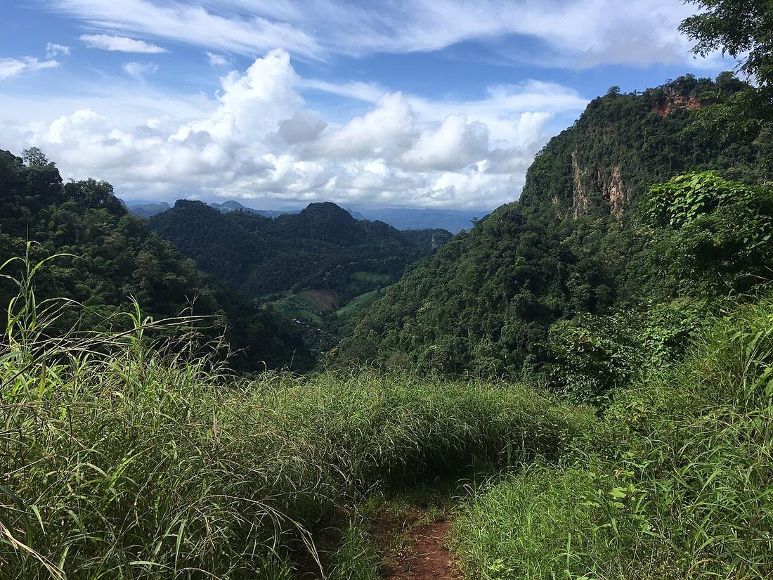 Christophe95 · CC BY-SA 4.0
What it is
The main settlement of Pang Mapha district, in limestone karst country. Officially Pang Mapha; on the road signs and in every conversation, Soppong.
The long version
Pang Mapha district is limestone, and limestone here means caves — the district holds a large number of them, including the one at Tham Lot with its river running through.
Inference — for a rider Soppong is the answer to a specific problem: the Pai to Mae Hong Son run is long enough to be a poor half-day and short enough to be a wasted full one, and Soppong sits in the middle of it. Staying here rather than pushing on buys you the caves in the morning light and takes the hardest descent off the end of a long day.
Now
Fuel, food, a few guesthouses, and no more than that. Treat the pump here as the last certain one before Mae Hong Son.
Stay 11
- 1 Lemon Hill House เลมอนฮิลล์ เกสเฮาส์ LemonHill Guesthouse guesthouse0.2 km by road own site +6653617039 Facebook map
- 2 Little Eden Guesthouse guesthouse0.4 km by road own site +66899528870 Facebook map
- 3 Jungle Guesthouse & restaurant guesthouse0.7 km by road +66948283865 Facebook map
- 4 Soppong River Inn hotel0.7 km by road own site +6653617107 Facebook map
- 5 The Aerie hotel0.7 km by road own site +66612157566 Facebook map
- 6 Northern Hill @ pangmapha Room from 300B in 2026 Northern Hill Guest House นอร์ทเทอร์นฮิลล์ guesthouse1.0 km by road +6653617136 Facebook map
11 beds within 6 km: OpenStreetMap (2026-09-19) and Overture Places (release 2026-09-23.1, mostly Facebook business pages), one row where both name the same place. Distance runs over OpenStreetMap streets from Soppong Post Office. Beds with a phone or site of their own come first. Not checked or endorsed; an absence here is an absence from those two maps.
Runs with
- stopTham Lot — The cave the district is known for.
- legPai to Soppong — The way in.
- legSoppong to Mae Hong Son — The way on, and the hardest descent of the northern leg.
Named here by
- legPai to Soppong — The town at the end.
- stopThe evening in Pai — The opposite of all of this, forty minutes on.
- stopTham Lot — The town it belongs to.
- stayWhere to put the nights — The stop that shortens the hardest day.
Where each claim comes from
| Field | Tier | Source | Note |
|---|---|---|---|
| default | cited | Pang Mapha district — Wikipedia (en) | |
| text.story | inference | the riding conclusions are this project's; the geography and history under them are cited | |
| text.today | inference | ||
| text_th | inference | written in Thai by this project, not machine-translated |
Sources
- Pang Mapha district — Wikipedia (en)
- Tham Lot cave — Wikipedia (en)
cited Cited — a named source, linked · harvested Harvested — fetched from an open dataset, with its licence · tradition Tradition — general knowledge of the tradition, hedged · inference Inference — this project's own reasoning from the above · field Field — someone stood there