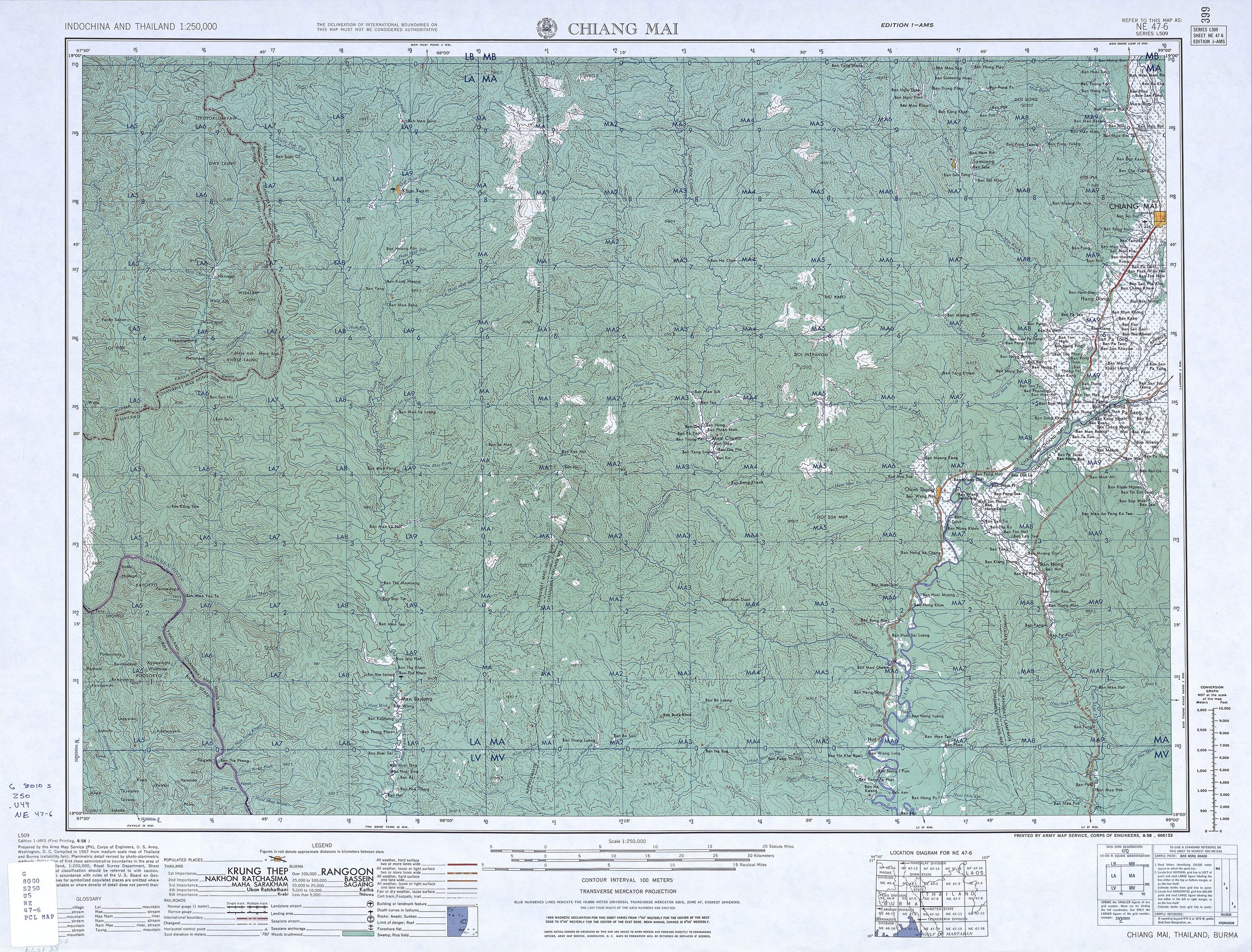
แผนที่เก่าแผ่น NE 47-6 เชียงใหม่ ของ Army Map Service
1:250,000 ชุด L509 และเป็นแผ่นแรกที่นี่ที่มีการจำแนกชั้นถนน
 United States Army Map Service · Public domain
คืออะไร
แผ่น NE 47-6 ของชุด L509 แผนที่มาตราส่วน 1:250,000 ครอบคลุมอินโดจีนและประเทศไทยของ US Army Map Service ปี 2497 มันแสดงภูมิภาคในช่วงก่อนซุปเปอร์ไฮเวย์ ถนนจำแนกตามผิวทางและฤดู ถนนลำพูนเป็นเส้นหลักลงใต้ และไม่มีวงแหวนใด ๆ รอบเมือง
ฉบับยาว
อนุมาน — แผนที่ทหารจำแนกถนนด้วยว่าเอารถบรรทุกลงไปได้ก่อในฤดูฝน ซึ่งเป็นสิ่งมีประโยชน์ที่สุดที่ใครเคยใส่ลงบนแผนที่ของจังหวัดนี้ ความแตกต่างนั้นหายไปจากแผนที่สมัยใหม่แล้ว ส่วนถนนที่มันบรรยายยังไม่หาย
เกี่ยวข้องกับ
- ทางหลวงแผ่นดินหมายเลข 106 — ถนนสายเก่าลงใต้ The main line south on it.
- ทางหลวงแผ่นดินหมายเลข 11 — ถนนซุปเปอร์ไฮเวย์ What came fifteen years later.
- ทศวรรษ 2510 — ซุปเปอร์ไฮเวย์ The era it precedes.
แต่ละข้อความมาจากไหน
| Field | Tier | Source | Note |
|---|---|---|---|
| default | cited | Wikimedia Commons — the map and photograph files, each with its own licence on its file page — Wikimedia Commons | |
| text_th | inference | written in Thai by this project, in the northern register where it fits; not machine-translated | |
| text.story | inference |
แหล่งอ้างอิง
- Wikimedia Commons — the map and photograph files, each with its own licence on its file page — Wikimedia Commons
cited Cited — a named source, linked · harvested Harvested — fetched from an open dataset, with its licence · tradition Tradition — general knowledge of the tradition, hedged · inference Inference — this project's own reasoning from the above · field Field — someone stood there