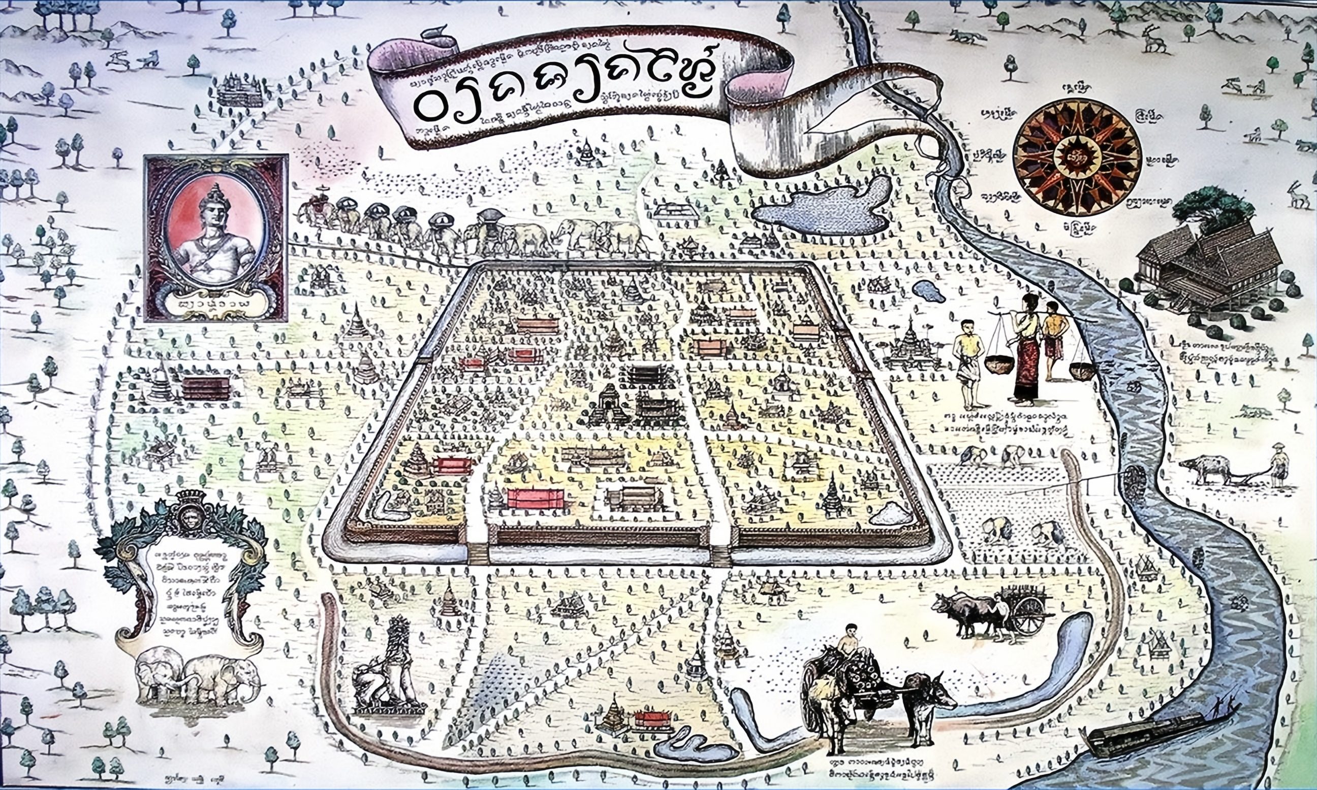
แผนที่เก่าแผนที่เวียงสมัยล้านนา
สี่เหลี่ยมวาดจากข้างใน กับรูปเจ้าอยู่ข้าง ๆ
 Unknown author · Public domain
คืออะไร
แผนที่เวียงสมัยล้านนาที่ไม่ระบุปี มีรูปเจ้าอยู่ด้านซ้าย มีคุ้ม วัด และกำแพง มันเป็นภาพของสถานที่ มากกว่าการรังวัดสถานที่ ไม่มีอะไรบนนั้นได้สัดส่วน และทุกอย่างบนนั้นอยู่ตรงที่มันควรอยู่
ฉบับยาว
อนุมาน — สิ่งที่มีประโยชน์ของแผนที่ที่ไม่ได้สัดส่วนคือมันบอกว่าอะไรสำคัญ กำแพงวาดหนา วัดวาดใหญ่ และถนนแทบไม่มี ถนนยังไม่ใช่สิ่งที่คนวาด
เกี่ยวข้องกับ
- คูเมือง The square it draws.
- พุทธศตวรรษ 19–23 — ล้านนากับพม่า Its era.
แต่ละข้อความมาจากไหน
| Field | Tier | Source | Note |
|---|---|---|---|
| default | cited | Wikimedia Commons — the map and photograph files, each with its own licence on its file page — Wikimedia Commons | |
| text_th | inference | written in Thai by this project, in the northern register where it fits; not machine-translated | |
| text.story | inference |
แหล่งอ้างอิง
- Wikimedia Commons — the map and photograph files, each with its own licence on its file page — Wikimedia Commons
cited Cited — a named source, linked · harvested Harvested — fetched from an open dataset, with its licence · tradition Tradition — general knowledge of the tradition, hedged · inference Inference — this project's own reasoning from the above · field Field — someone stood there