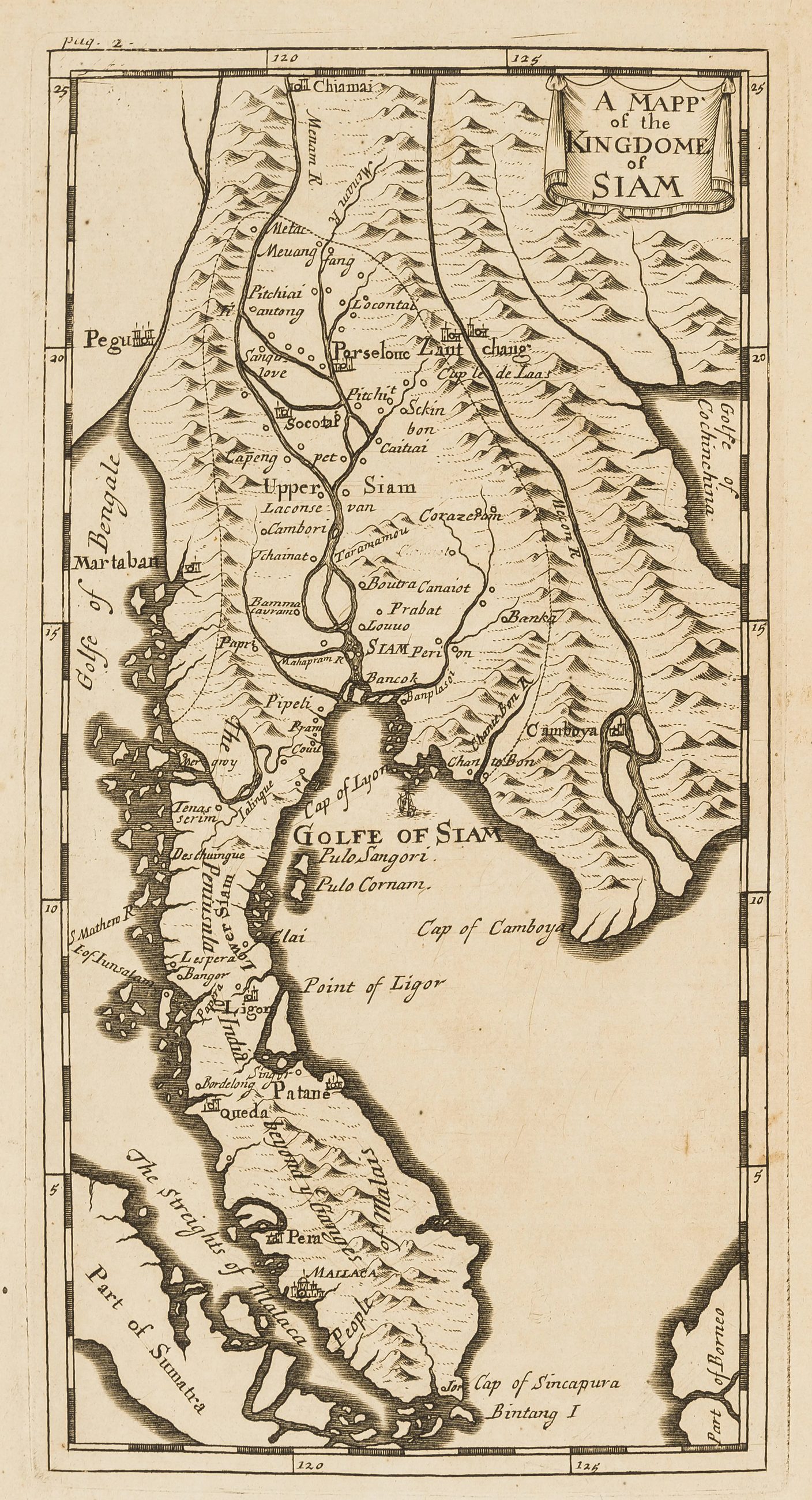
แผนที่เก่าสยามของลูแบร์ 2236
แผ่นเก่าสุดที่นี่ และไม่มีเชียงใหม่อยู่บนมัน
 Simon de la Loubère · Public domain
คืออะไร
แผนที่สยามของซีมง เดอ ลา ลูแบร์ ฉบับภาษาอังกฤษ จากบันทึกคณะทูตของเขาที่อยุธยา ล้านนาไม่ใช่สยามในปี 2236 และภาคเหนือของแผนที่นี้เป็นการเดา มันอยู่ที่นี่ในฐานะเส้นฐาน ภาพวาดยุโรปชิ้นแรกของอาณาจักรที่เมืองนี้จะถูกปกครองจากมันในภายหลัง
ฉบับยาว
อนุมาน — สองร้อยปีหลังแผนที่นี้ ทางไปเชียงใหม่จากกรุงเทพฯ คือแม่น้ำ และแผนที่แสดงอย่างนั้น น้ำถูกวาด ทางบกไม่ถูกวาด โครงข่ายถนนของจังหวัดนี้เริ่มบนกระดาษในทศวรรษ 2420 กับปาวีและแม็กคาร์ธี
เกี่ยวข้องกับ
- เส้นทางเดินทางของปาวี 2423–2427 Where the land routes start.
แต่ละข้อความมาจากไหน
| Field | Tier | Source | Note |
|---|---|---|---|
| default | cited | Wikimedia Commons — the map and photograph files, each with its own licence on its file page — Wikimedia Commons | |
| text_th | inference | written in Thai by this project, in the northern register where it fits; not machine-translated | |
| text.story | inference |
แหล่งอ้างอิง
- Wikimedia Commons — the map and photograph files, each with its own licence on its file page — Wikimedia Commons
cited Cited — a named source, linked · harvested Harvested — fetched from an open dataset, with its licence · tradition Tradition — general knowledge of the tradition, hedged · inference Inference — this project's own reasoning from the above · field Field — someone stood there