สถานที่แม่น้ำปิง
แม่น้ำตี้เมืองตั้งใจตั้งห่างมันหนึ่งกิโล
 Takeaway · CC BY-SA 3.0
18.7900, 99.0040 · OpenStreetMap · แผนที่
คืออะไร
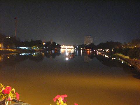
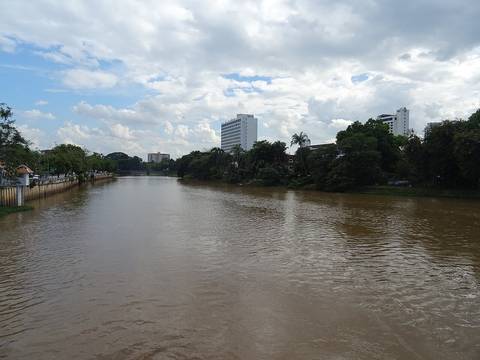
แม่น้ำทางตะวันออกของเวียงเก่า พญามังรายวางเวียงบนที่สูงระหว่างดอยสุเทพกับแม่ปิง ไม่ใช่บนฝั่ง ฝั่งน้ำท่วมตอนนั้นและท่วมตอนนี้ ขัวข้ามทุกแห่งถูกนับจากแผนที่บนเว็บนี้ และขัวที่มีเรื่องเล่ามีบันทึกของตัวเอง
ฉบับยาว
ตุลาคม 2567 สถานีวัดน้ำ P.1 ที่สะพานนวรัฐอ่านได้ 5.30 เมตรตอนเที่ยงวันที่ 5 ตุลาคม สูงกว่าตลิ่ง 1.10 เมตร 638 ลูกบาศก์เมตรต่อวินาที ถนนท่าแพจมจากสะพานถึงธนาคารกรุงไทย ซุปเปอร์ไฮเวย์ สะพานข้ามแยกดอนจั่นและเชียงคำ ถนนมหิดลทั้งสาย กาดหลวง สถานีรถไฟ และแยกหนองประทีปจมหมด น้ำแผ่ไปทางตะวันออกของแม่น้ำราว 2 กม.
เกี่ยวข้องกับ
- ขัวรถข้ามแม่ปิง นับแล้ว How many bridges, counted.
- สะพานนวรัฐ The gauge is on it.
- วันที่แม่น้ำขึ้นมาถึงท่าแพ The flood, told.
ถูกอ้างถึงโดย
- เส้นทางขึ้นเหนือของบ็อก 2424 How he came up.
- ขัวรถข้ามแม่ปิง นับแล้ว The river.
- วันที่แม่น้ำขึ้นมาถึงท่าแพ The river.
- เวียงกุมกาม What drowned it.
แต่ละข้อความมาจากไหน
| Field | Tier | Source | Note |
|---|---|---|---|
| default | cited | Ping River — Wikipedia (en) | |
| text_th | inference | written in Thai by this project, in the northern register where it fits; not machine-translated |
แหล่งอ้างอิง
- Ping River — Wikipedia (en)
- น้ำท่วมเชียงใหม่ 7 ต.ค. 2567 — ถนนที่จม — Lanner
- น้ำท่วมเชียงใหม่ 2567 — ระดับน้ำ P.1 — Thai PBS
- น้ำปิงท่วมเชียงใหม่ ต.ค. 2567 — Bangkok Biz News
cited Cited — a named source, linked · harvested Harvested — fetched from an open dataset, with its licence · tradition Tradition — general knowledge of the tradition, hedged · inference Inference — this project's own reasoning from the above · field Field — someone stood there