แผนที่เก่าเส้นทางขึ้นเหนือของบ็อก 2424
ชาวนอร์เวย์เดินไปเชียงแสนแล้ววาดทางที่เขาไป
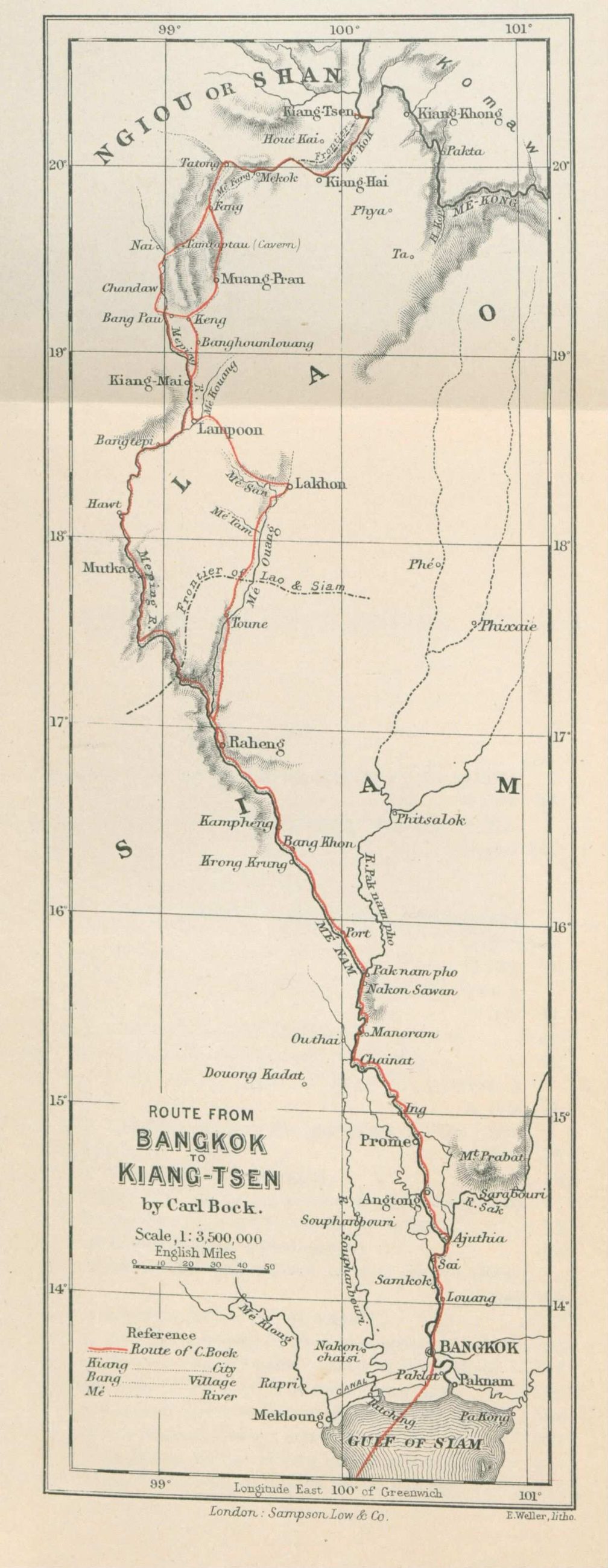 Carl Bock (1849-1932), Edward Weller (cartographer) (1819–1884) · Public domain
คืออะไร
แผนที่เส้นทางจากกรุงเทพฯ ถึงเชียงแสนของคาร์ล บ็อก จากหนังสือ Through Upper Siam and Lao บันทึกการเดินทางสำรวจที่ตีพิมพ์ปี 2427 แผ่นนี้เป็นแถบ ยาวและแคบเพราะเส้นทางยาวและแคบ และทุกอย่างสองข้างว่างเปล่าเพราะเขาไม่ได้ไปตรงนั้น
ฉบับยาว
อนุมาน — แผนที่แบบแถบคือสิ่งที่คุณวาดเมื่อมีทางไปทางเดียว บ็อกขึ้นแม่ปิงด้วยเรือและข้ามช่องเขาด้วยช้าง และแผ่นนี้มีรูปร่างเหมือนการเดินทางนั้น เก้าสิบปีต่อมา ทริปเดียวกันคือทางหลวง 11 กับ 118 และไปได้ระหว่างมื้อเช้ากับมื้อเที่ยง
เกี่ยวข้องกับ
- เส้นทางเดินทางของปาวี 2423–2427 The same decade, the same problem.
- แม่น้ำปิง How he came up.
- ทางหลวงแผ่นดินหมายเลข 118 — เชียงใหม่–เชียงราย What the journey is now.
แต่ละข้อความมาจากไหน
| Field | Tier | Source | Note |
|---|---|---|---|
| default | cited | Wikimedia Commons — the map and photograph files, each with its own licence on its file page — Wikimedia Commons | |
| text_th | inference | written in Thai by this project, in the northern register where it fits; not machine-translated | |
| text.story | inference |
แหล่งอ้างอิง
- Wikimedia Commons — the map and photograph files, each with its own licence on its file page — Wikimedia Commons
cited Cited — a named source, linked · harvested Harvested — fetched from an open dataset, with its licence · tradition Tradition — general knowledge of the tradition, hedged · inference Inference — this project's own reasoning from the above · field Field — someone stood there