จราจรเมืองแผ่ไปไกลแค่ไหน
พื้นที่สิ่งปลูกสร้าง 13 ตร.กม. ปี 2495 137 ตร.กม. ปี 2552 สิบเท่า ในช่วงชีวิตต้นยางต้นเดียว
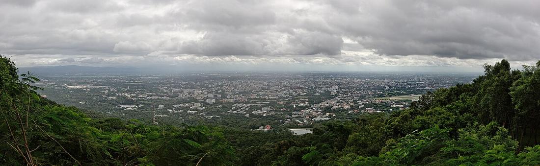 Pratyeka · CC BY-SA 4.0
นับอย่างไร. ตัวเลขจากบทคัดย่อของงานวิจัยแลนด์แซต งานที่สองให้ 339 ตร.กม. ปี 2543 ใช้เขตต่างกันและไม่นำมาปน
คืออะไร
การศึกษาของ ม.เชียงใหม่ จากภาพแลนด์แซตให้พื้นที่สิ่งปลูกสร้าง 13 ตร.กม. ปี 2495 และ 137 ตร.กม. ปี 2552 ในเขตผังเมืองรวม พื้นที่เมืองจากร้อยละ 10.6 ปี 2532 เป็น 12.1 ปี 2543 และ 18.3 ปี 2552 แบบจำลองคาดร้อยละ 38 ปี 2553 ถึง 80 ปี 2573 อาคารเพิ่มหนึ่งในสามระหว่าง 2543–2556 หนึ่งในห้าของการเติบโตอยู่นอกเขตผัง เขตมหานครมีคน 1,059,462 บน 3,142 ตร.กม. ปี 2567
ฉบับยาว
อนุมาน — วงแหวนทุกวงบนเว็บนี้วาดรอบเมืองที่เล็กกว่านี้หลายเท่า วงแหวนรอบนอกกำหนดปี 2532 ตอนพื้นที่สิ่งปลูกสร้างเป็นหนึ่งในสิบของเขตผัง พอมันปิดวง เมืองก็มาถึงวงแล้ว
เกี่ยวข้องกับ
- 2527–2549 — ยุควงแหวน When the rings were drawn on it.
- ถนนต้นยาง เชียงใหม่–ลำพูน The tree.
แต่ละข้อความมาจากไหน
| Field | Tier | Source | Note |
|---|---|---|---|
| default | cited | Urban growth of Chiang Mai from Landsat, 1952–2009 — Sangawongse, J. Social Sciences CMU 21(1) — Chiang Mai University | |
| text_th | inference | written in Thai by this project, in the northern register where it fits; not machine-translated | |
| text.story | inference |
แหล่งอ้างอิง
- Urban growth of Chiang Mai from Landsat, 1952–2009 — Sangawongse, J. Social Sciences CMU 21(1) — Chiang Mai University
- Chiang Mai land use and SLEUTH projection — Urban Planning 2(1), 2017 — Cogitatio
- Chiang Mai Metropolitan Area — Wikipedia (en)
cited Cited — a named source, linked · harvested Harvested — fetched from an open dataset, with its licence · tradition Tradition — general knowledge of the tradition, hedged · inference Inference — this project's own reasoning from the above · field Field — someone stood there