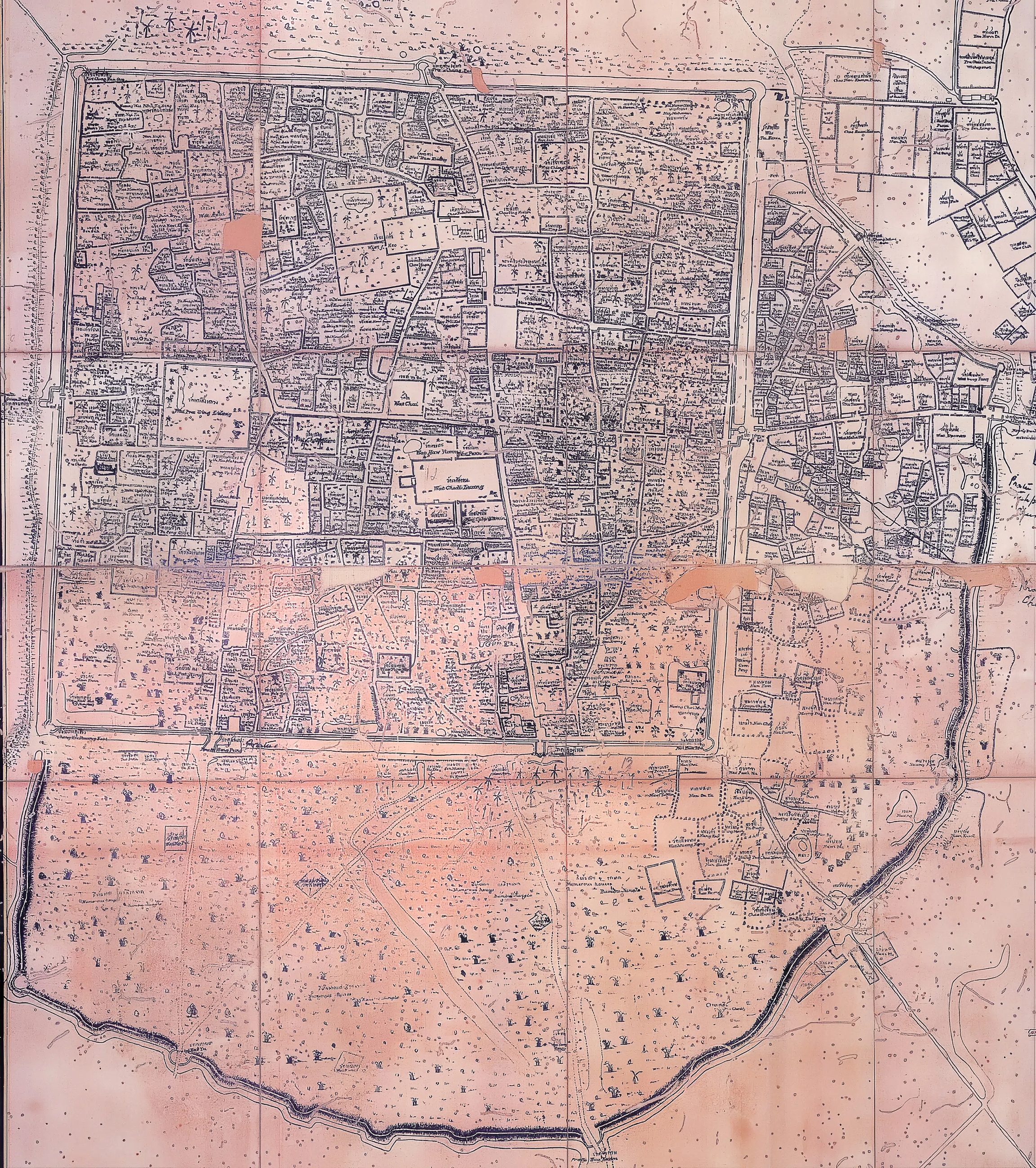
แผนที่เก่าแผนที่ 2436 สำหรับพระเจ้าอินทวิชยานนท์
กำแพงสองชั้น วาดให้กษัตริย์ที่ยังมีราชสำนัก
 Unknown author · Public domain
คืออะไร
วาดถวายพระเจ้าอินทวิชยานนท์ เจ้าหลวงองค์สุดท้ายก่อนข้าหลวงสยามเข้ามาจัดการภาคเหนือ มันแสดงกำแพงทั้งสองชั้น สี่เหลี่ยมอิฐชั้นในและคันดินชั้นนอกที่โค้งล้อมย่านค้าขายด้านตะวันออก
เกี่ยวข้องกับ
- กำแพงดิน The wall it still shows.
- เจ้าพระยาสุรสีห์วิสิษฐศักดิ์ The commissioner who followed.
- 2339–2443 — ยุคพระเจ้ากาวิละ Its era.
แต่ละข้อความมาจากไหน
| Field | Tier | Source | Note |
|---|---|---|---|
| default | cited | Wikimedia Commons — the map and photograph files, each with its own licence on its file page — Wikimedia Commons | |
| text_th | inference | written in Thai by this project, in the northern register where it fits; not machine-translated |
แหล่งอ้างอิง
- Wikimedia Commons — the map and photograph files, each with its own licence on its file page — Wikimedia Commons
cited Cited — a named source, linked · harvested Harvested — fetched from an open dataset, with its licence · tradition Tradition — general knowledge of the tradition, hedged · inference Inference — this project's own reasoning from the above · field Field — someone stood there