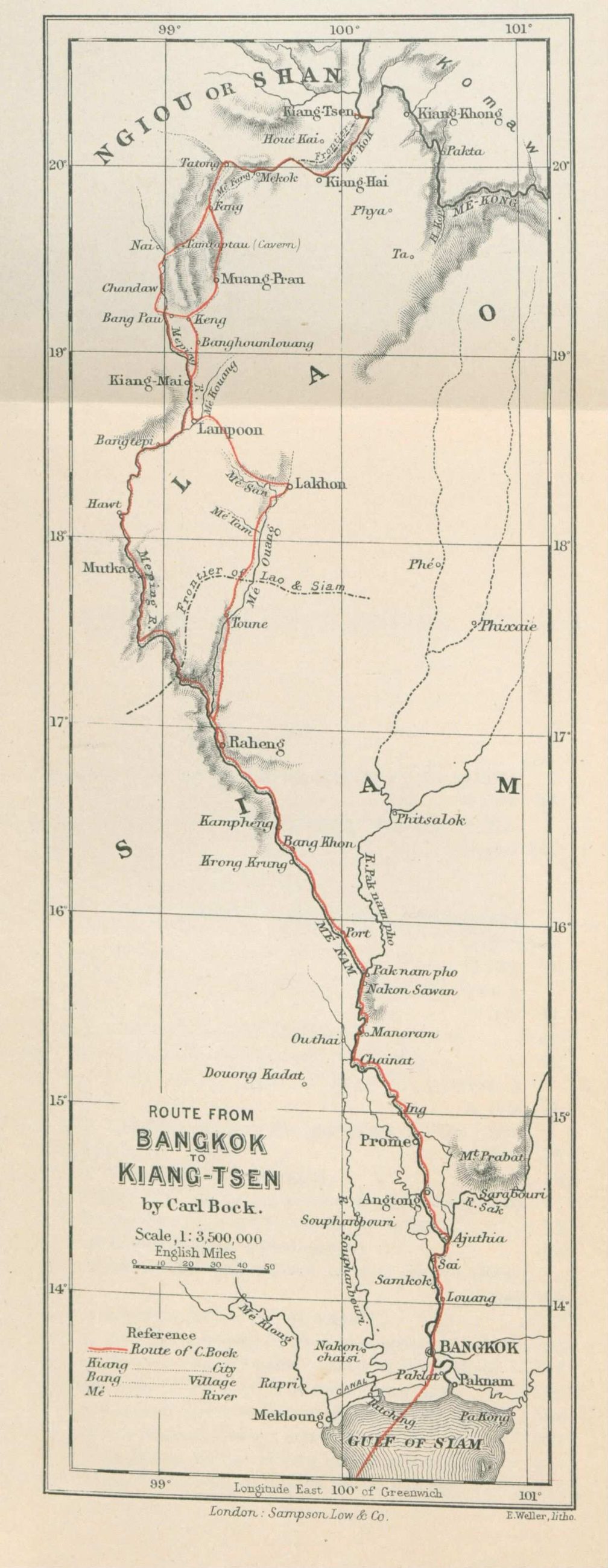
mapBock's route to the north, 1881
เส้นทางขึ้นเหนือของบ็อก 2424
A Norwegian walked to Chiang Saen and drew the way he went.
 Carl Bock (1849-1932), Edward Weller (cartographer) (1819–1884) · Public domain
What it is
Carl Bock's map of the route from Bangkok to Chiang Saen, from Through Upper Siam and Lao, his narrative of a journey of exploration published in 1884. The sheet is a strip: it is long and narrow because a route is long and narrow, and everything either side of it is blank because he did not go there.
The long version
Inference — a strip map is what you draw when there is one way to go. Bock went up the Ping by boat and over the passes by elephant, and the sheet is shaped like that journey. Ninety years later the same trip is Route 11 and Route 118 and you can do it between breakfast and lunch.
Connected to
- Pavie's itineraries, 1880–1884 The same decade, the same problem.
- The Ping How he came up.
- Route 118, to Chiang Rai What the journey is now.
Where each claim comes from
| Field | Tier | Source | Note |
|---|---|---|---|
| default | cited | Wikimedia Commons — the map and photograph files, each with its own licence on its file page — Wikimedia Commons | |
| text_th | inference | written in Thai by this project, in the northern register where it fits; not machine-translated | |
| text.story | inference |
Sources
- Wikimedia Commons — the map and photograph files, each with its own licence on its file page — Wikimedia Commons
cited Cited — a named source, linked · harvested Harvested — fetched from an open dataset, with its licence · tradition Tradition — general knowledge of the tradition, hedged · inference Inference — this project's own reasoning from the above · field Field — someone stood there