⛰ ดอย — แผ่นดินเชียงใหม่ · เชียงราย · The doi — the shape of the land
เมืองนี้ตั้งอยู่ก้นแอ่ง — พื้นราว 313 เมตรเหนือระดับน้ำทะเล มีสันดอยล้อมทุกด้าน หน้านี้วางพื้นดินจริงไว้ใต้แผนที่: แสงเงาตามความสูงบนแผนที่ทุกซูม กดดู 3 มิติได้ และภาพตัดขวางของแอ่งที่วาดจากไฟล์เดียวกับที่แผนที่อ่าน · The city sits on a basin floor about 313 metres above the sea, ringed by ranges on every side. This page puts the real ground under the map — relief shading at every zoom, a 3D mode one tap away, and a cross-section of the basin drawn from the same file the map reads.
แผนที่พื้นดิน · The ground map
ภาพตัดขวางคือแผนที่ของหน้านี้เมื่อไม่มีไทล์ — พื้นจริงขึ้นเองเมื่อโหลดได้ · The cross-section is this page's map when tiles cannot load — the live ground mounts by itself when it can
ลากด้วยนิ้วเดียวได้เลย หน้านี้แผนที่คือหน้า · ปุ่มขึ้นเองเมื่อพื้นพร้อม · One finger pans — on this page the map is the page · the buttons appear when the ground is ready
ตัวเลขที่เครื่องอ่านได้ · What the instrument read
เก้าที่ เก้าความสูง · Nine places, nine heights
หมุดของสารบัญเอง อ่านความสูงจากแบบจำลองเดียวกับแผนที่ · เรียงตามเมตรที่อ่านได้ ไม่ใช่อันดับความสำคัญ · กดชื่อเข้าหน้าของแต่ละที่ได้ · The directory's own pins, heights read from the same model the map draws · ordered by the metres read, not by importance · every name opens its own page
| ที่ · place | จังหวัด · province | เมตร · m |
|---|---|---|
| ดอยอ่างขาง · Doi Angkhan | เชียงใหม่ | 1,907 |
| ภูชี้ฟ้า · Phu Chi Fa | เชียงราย | 1,596 |
| ม่อนแจ่ม · Mon Cham | เชียงใหม่ | 1,303 |
| ดอยตุง · Doi Tung | เชียงราย | 1,292 |
| วัดพระธาตุดอยสุเทพ · wat Phrathat Doi Suthep Racha Worawihan | เชียงใหม่ | 1,056 |
| วัดพระธาตุดอยคำ · Wat Phra That Doi Kham | เชียงใหม่ | 472 |
| หอนาฬิกา · Clock Tower | เชียงราย | 400 |
| วัดร่องขุ่น | เชียงราย | 399 |
| ทะเลสาบห้วยตึงเฒ่า · Huay Tueng Tao Lake | เชียงใหม่ | 349 |
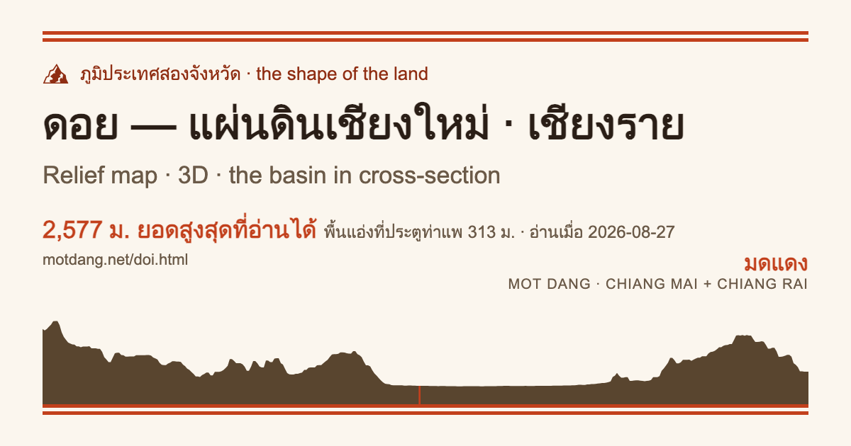
แอ่งเชียงใหม่ — ภาพตัดขวาง · The Chiang Mai basin, in cross-section
เส้นตัดที่ละติจูดของประตูท่าแพ (18.7876°N) จาก 98.55° ถึง 99.45° ตะวันออก — แกนตั้งยืดราว 20 เท่าเพื่อให้อ่านได้ ภาพจึงชันกว่าดอยจริง · อ่านเมื่อ 2026-08-27 · Cut at the Tha Phae Gate latitude (18.7876°N), 98.55° to 99.45°E — the vertical axis is stretched about 20× to be readable, so the picture is steeper than the doi · read 2026-08-27
ที่ราบเชียงราย — ภาพตัดขวาง · The Chiang Rai plain, in cross-section
เส้นตัดที่ละติจูดของหอนาฬิกาเชียงราย (19.9094°N) จาก 99.40° ถึง 100.30° ตะวันออก — แกนตั้งยืดราว 20 เท่าเพื่อให้อ่านได้ ภาพจึงชันกว่าดอยจริง · อ่านเมื่อ 2026-08-27 · Cut at the Chiang Rai clock tower latitude (19.9094°N), 99.40° to 100.30°E — the vertical axis is stretched about 20× to be readable, so the picture is steeper than the doi · read 2026-08-27
อ่านแผ่นดินจากชื่อบ้าน · Reading the land through its names
- ดอย (doi) — ภูเขา ในคำเมือง: ดอยสุเทพ ดอยอินทนนท์ · ไทยกลางว่า ภูเขา · ร่วมเชื้อกับ “loi” ของไทใหญ่ · doi (ดอย) — mountain, in the northern tongue: Doi Suthep, Doi Inthanon; standard Thai says phukhao; kin to Shan loi
- ม่อน (mɔ̂n) — เนินยอดมน: ม่อนแจ่ม · mon (ม่อน) — a rounded knoll: Mon Cham
- ขุน (khǔn) — ต้นน้ำ “หัวหน้า” ของลำน้ำ: ขุนช่างเคี่ยน ขุนวาง · khun (ขุน) — a river's headwaters, its chief: Khun Chang Khian, Khun Wang
- แม่ (mɛ̂ɛ) — แม่น้ำ นำหน้าชื่อบ้านริมน้ำทั่วเหนือ: แม่ริม แม่แตง แม่ปิง · mae (แม่) — mother, the river word that fronts half the north's town names: Mae Rim, Mae Taeng, the Mae Ping
- ห้วย (hûai) — ลำห้วย: ห้วยตึงเฒ่า ห้วยแก้ว · huai (ห้วย) — a creek: Huai Tueng Thao, Huai Kaeo
- ผา (phǎa) — หน้าผา: ผาช่อ ผาลาด · pha (ผา) — a cliff: Pha Chor, Pha Lat
- โป่ง (pòong) — แอ่งแร่ที่ซึมจากดิน: โป่งเดือด — ต่อที่หน้าน้ำพุร้อน · pong (โป่ง) — a mineral seep: Pong Duet — the hot-springs page carries the rest
- แอ่ง (ɛ̀ng) — ที่ลุ่มระหว่างดอย: แอ่งเชียงใหม่ ที่ภาพตัดบนหน้านี้วาดไว้ · aeng (แอ่ง) — the basin between the doi: the Chiang Mai basin this page's cross-section draws
- น้ำตก (nám-tòk) — น้ำตก: แม่สา บัวตอง · ส่วน “ลาบ-น้ำตก” ในเมนูคือมื้อเที่ยง คนละเรื่อง · namtok (น้ำตก) — a waterfall: Mae Sa, Bua Tong · the menu's nam tok is lunch, a different story
ตามรากศัพท์ต่อได้ที่ wichaa.net/thairoots — ดอย ม่อน ขุน แม่ ห้วย ผา โป่ง ล้วนเป็นคำไทแท้ · follow the roots at wichaa.net/thairoots — doi, mon, khun, mae, huai, pha and pong are all old Tai stock
หมุดที่บอกความสูงแล้ว (407 ที่ อ่านจากแบบจำลองเดียวกัน): Pins that now carry their height (407 of them, read from this same model): ยอดดอย เชียงใหม่ · peaks CM · เชียงราย · CR — จุดชมวิว เชียงใหม่ · viewpoints CM · เชียงราย · CR — น้ำตก เชียงใหม่ · waterfalls CM · เชียงราย · CR
ไปต่อ: Onward: ♨️ น้ำพุร้อน — โป่งทั้งภาคเหนือ · hot springs — the north's pong · ถนนและซอยที่ปีนดอยพวกนี้ · the roads and sois that climb these doi
ทะเบียนดิบ · Raw readings: data/terrain_meta.json · data/terrain_profile.json · เห็นเลขที่ควรอ่านใหม่ — a reading that needs re-reading — บอกมด · tell the ants