The moat loop
Hartmann Linge · CC BY-SA 4.0ถนนรอบคูเมือง
The pair of one-way roads on the two banks of the moat: the outer bank runs clockwise, the inner counter-clockwise, so that the square is a…
The moat loop and three rings around it, each a decision about where the city ends, each overtaken by the city in ten to fifteen years.
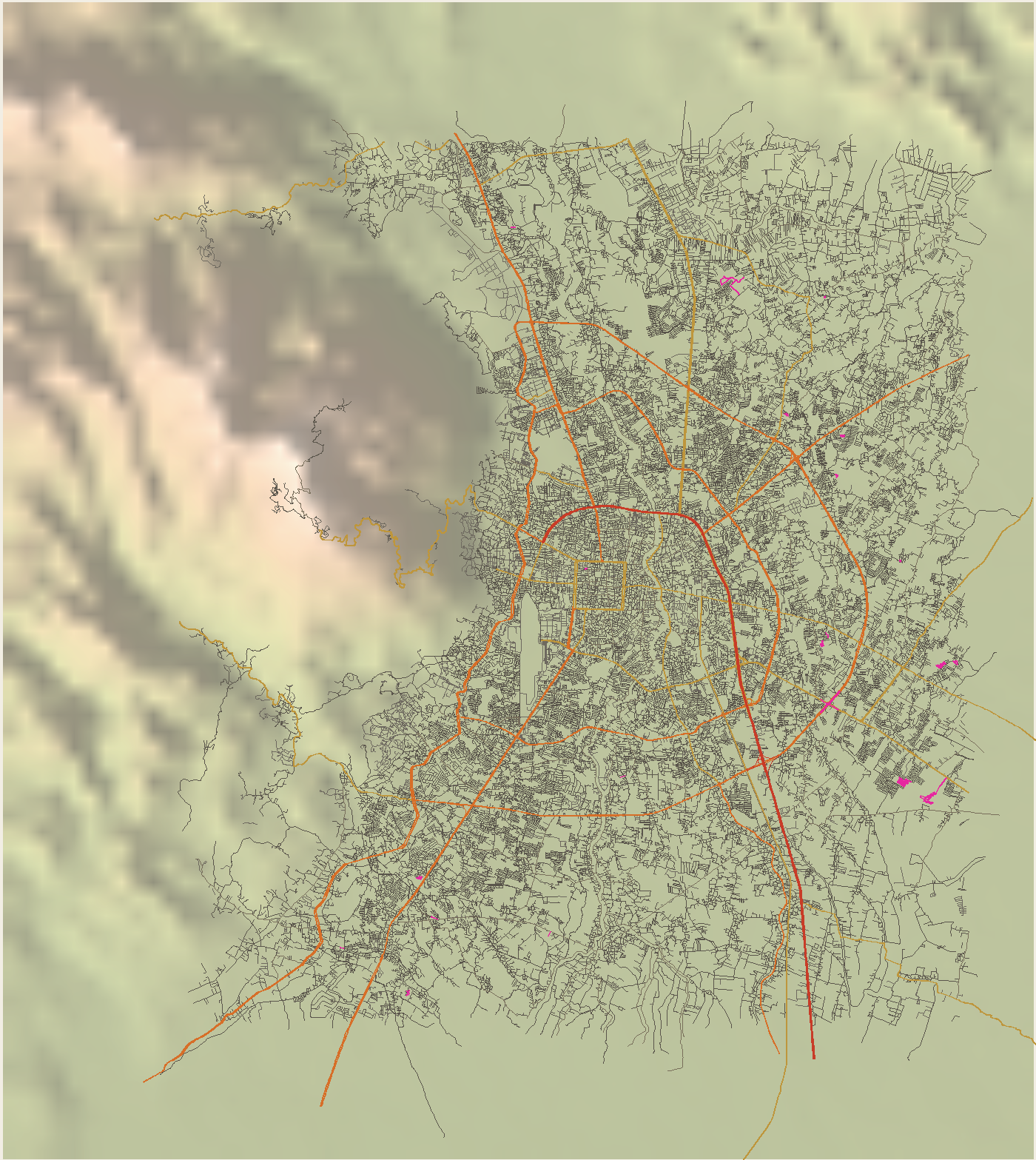
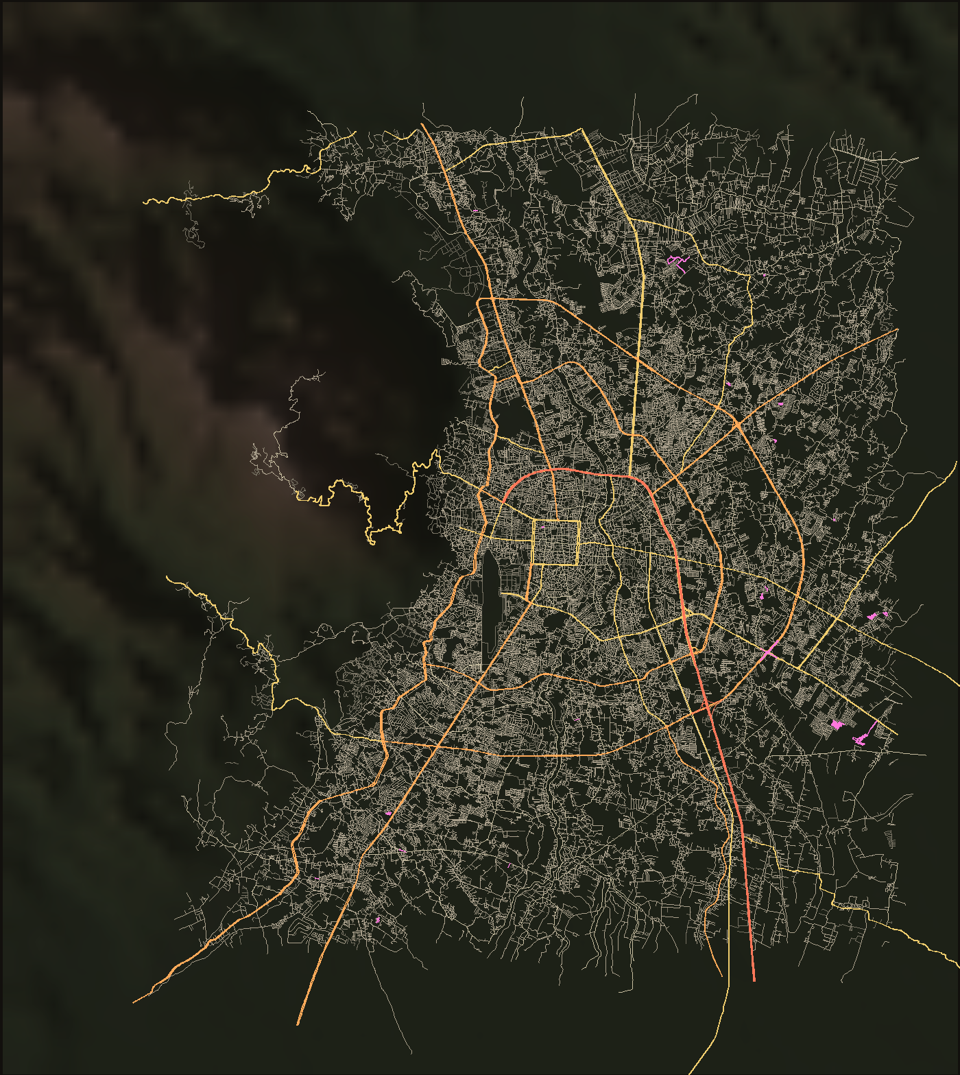
| Ring | km | lanes | opened | zone, measured | intersections / km² | dead ends | grid score |
|---|---|---|---|---|---|---|---|
| The moat loop | 6.54 | 1948 | inside the moat | 134.8 | 14% | 0.67 | |
| Ring 1, the Superhighway ring | moat to 3 km | 82.0 | 26% | 0.17 | |||
| Ring 2, the 700 Years Road | 26.13 | 6 | 2006-02-06 | 3 to 5.5 km | 77.9 | 32% | 0.09 |
| Ring 3, Route 121 | 52.957 | 1994 begun | 5.5 to 9 km | 57.9 | 35% | 0.07 | |
| Ring 4, drawn but not dug | 50 | past 9 km | 31.0 | 35% | 0.03 |
The zone a ring is measured against is a radius from the moat’s centre, not the ring’s own line; the measurements page explains.
The west side runs along the irrigation canal under Doi Suthep. An elevated road on top of it is under study, and the objection on record is the view.
Route 121ถนนรอบคูเมือง
The pair of one-way roads on the two banks of the moat: the outer bank runs clockwise, the inner counter-clockwise, so that the square is a…
วงแหวนรอบที่ 1
The ring about 3 km out: the last ten kilometres of Route 11, the Superhighway, on the north and east; Mahidol Road, Route 1141, on the south…
วงแหวนรอบกลาง — ถนนสมโภชเชียงใหม่ 700 ปี
The middle ring, about 5 km out, named for the city's 700th anniversary of 1996. Laid out in the first comprehensive plan of 1984 and fixed by…
วงแหวนรอบนอก — ทางหลวง 121
The outer ring, about 9 km out: a 52.957 km closed loop through Hang Dong, Saraphi, San Kamphaeng, Doi Saket, San Sai and Mae Rim, crossing the Ping…
วงแหวนรอบที่ 4
A fourth ring of about 50 km through Hang Dong, Saraphi, San Kamphaeng, Doi Saket, San Sai and Mae Rim, costed at about 5,000 million baht, at the…
แยกสนามบิน
The junction of Mahidol Road with the airport approach and the road to Hang Dong, on the first ring's southern arc. It has an underpass; the year it…
ทางลอดฟ้าฮ่าม
Where Route 1001, the Mae Jo and Phrao road, crosses the Superhighway northeast of the city. Highway department; built from March 2015; opened 9 June…
ทางลอดข่วงสิงห์
Where Chotana Road, Route 107, crosses the Superhighway at the northern edge of the first ring. Begun 2003 with the San Dek underpass; the contractor…
แยกหนองหอย
Where Mahidol Road crosses Route 106, the old Lamphun road, at km 2, east of the river. There is an underpass; its opening year is not on this disk.…
แยกรินคำ
Where Huay Kaew Road, Nimmanhaemin and the Superhighway meet, northwest of the moat. The 2025 public-transport master plan names it a critical…
ทางลอดเจ็ดแห่งของวงแหวนรอบกลาง
The middle ring dives under each radial highway it crosses: Routes 107, 1001, 118, 1006, 1317, 106 and 108, seven underpasses of four lanes finished…
ทางลอดสันเด็ก
Where the road to the Arcade bus station and Kaew Nawarat cross the Superhighway on the east. Same contract, same abandonment and same six-month…
ทางแยกต่างระดับสันกลาง
Route 1317 across Route 121, east of the city. Thai PBS reported it more than half built in 2025 at 1,425 million baht; a second phase of 430 million…
อุโมงค์เลี่ยงเมืองสันป่าตอง–หางดง
Department of Rural Roads, linking Route 121 to Route 1269: 1.83 km in all with a twin underpass of 462.5 m, 720.3 million baht, more than eighty…