placeKamphaeng Din, the earthen wall
กำแพงดิน · Kamphaeng Din
The second wall, the curved one, mostly gone.
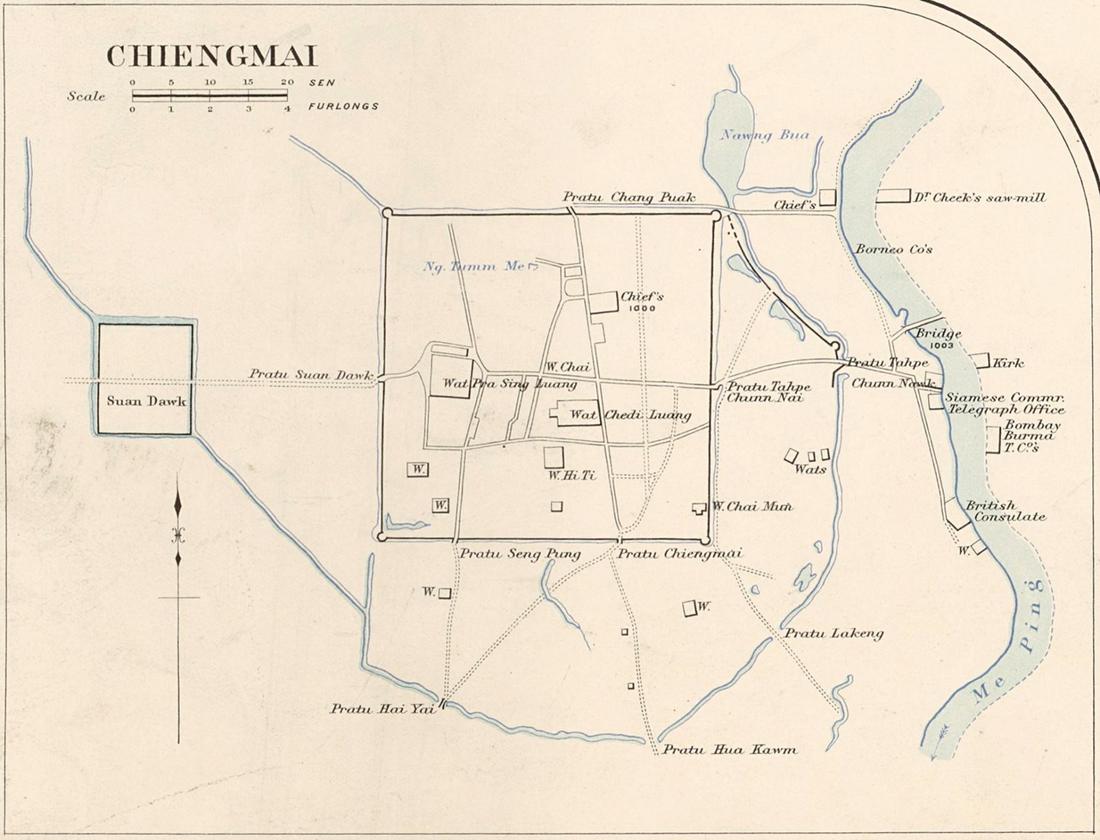 James McCarthy (1853–1919) · Public domain
18.7855, 98.9990 · OpenStreetMap · The map
What it is
A semicircular outer rampart of earth, running from Si Phum Corner round the east side and along the south to Ku Hueang Corner, enclosing the trading quarter between the square and the river. No firm date; presumed Mangrai's era. Brick was found under the bank on the southwest stretch. Parts survive beside the Night Bazaar, where Kamphaeng Din Road runs on its line.
The long version
Inference — the earthen wall is the reason the city is not a square: the streets between Tha Phae and Chang Klan bend, because they follow a curve that has been demolished. The length in kilometres is not on this disk.
Notes
The 1931 city map draws its line: a heavy dashed boundary running from ประตูหายยา Hai Ya Gate in the southwest, round the south and east, to ประตูขัวก้อม Kua Kom Gate. That line is the best picture of the earthen wall on this site, and it is on a sheet rather than on the ground.
Connected to
- Kamphaeng Din Road The road on its line.
- Si Phum Corner Where it starts.
- กำแพง kamphaeng The word.
- The 1931 city map Where its line is drawn.
Named here by
- Chang Klan Road The wall it runs inside.
- Kamphaeng Din Road The wall.
- The 1890 city map The outer wall.
- The 1893 map for Inthawichayanon The wall it still shows.
- กำแพง kamphaeng The earthen one.
- Mae Kha canal Ran outside it.
Where each claim comes from
| Field | Tier | Source | Note |
|---|---|---|---|
| default | cited | กำแพงดิน เชียงใหม่ — ทะเบียนแหล่งสิ่งแวดล้อมศิลปกรรม — ONEP | |
| text_th | inference | written in Thai by this project, in the northern register where it fits; not machine-translated |
Sources
- กำแพงดิน เชียงใหม่ — ทะเบียนแหล่งสิ่งแวดล้อมศิลปกรรม — ONEP
- ประวัติถนนลอยเคราะห์–ถนนกำแพงดิน — SumUp TH
- Wikimedia Commons — the map and photograph files, each with its own licence on its file page — Wikimedia Commons
cited Cited — a named source, linked · harvested Harvested — fetched from an open dataset, with its licence · tradition Tradition — general knowledge of the tradition, hedged · inference Inference — this project's own reasoning from the above · field Field — someone stood there