Stories The long reads: what a road does to an old city, why the moat runs one way, the trees, the flood, the monk.
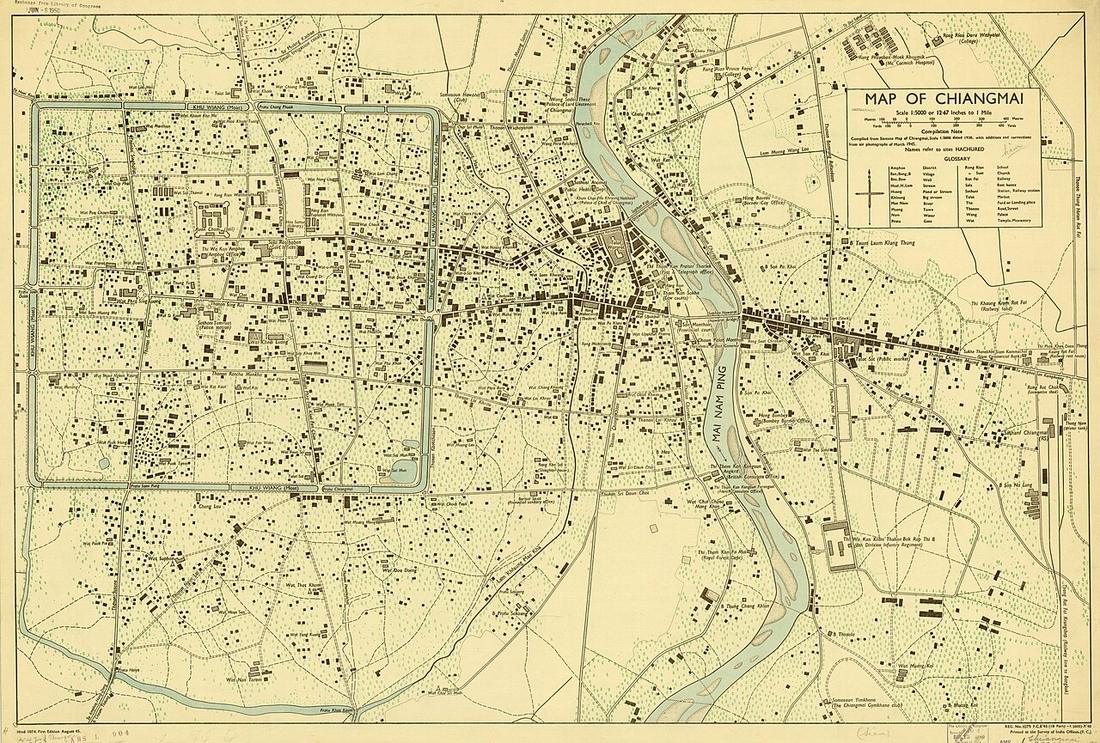
The site's spine. It takes every drivable way OpenStreetMap holds for the city and asks the same questions of the square inside the moat and of each ring outside it: how many intersections per square kilometre, how many lanes end in a dead end, how long a block is, how strongly the streets keep to a grid, how much of the network runs one way, how many wats sit in each zone. The measurements page has the numbers; this page reads them.
The whole argument
Takeaway · CC BY-SA 4.0 ถนนคนเดิน และถนนกลายเป็นพื้นได้อย่างไร
A pilot called Ten Wonders of Lanna at Tha Phae ran on Sundays from 3 February to 7 April 2002; the municipality took it over weekly from 14 April…
walk market
Christophe95 · CC BY-SA 4.0 วันที่แม่น้ำขึ้นมาถึงท่าแพ
The Ping's October 2024 flood as a list of roads. The gauge at Nawarat Bridge, P.1, bank level 3.70 m, read 4.93 on 26 September, 5.26 at eleven on…
flood
Kimtuy · CC BY-SA 4.0 ตนบุญผู้สร้างถนนในห้าเดือน
Kruba Srivichai's road to Wat Phra That Doi Suthep, the one road in this catalogue that a congregation built. Ground broken 9 November 1934, Chao…
wat heritage
FredTC · CC BY-SA 4.0 ต้นยางบนถนนลำพูน
About a thousand yang-na along the old road south, from the Nawarat Bridge to the provincial line, ordered under Chao Phraya Surasi, Siam's high…
trees controversy
User:Amada44 · CC BY-SA 4.0 สิ่งที่เว็บนี้บ่มี
No live traffic. No accident locations by road: nobody publishes them for these roads, so the deaths page is by province and year. No…
Hartmann Linge · CC BY-SA 4.0 ทำไมรอบคูเมืองวิ่งทางเดียว
The pair of roads the municipality built on the moat's banks in 1948 run as two one-way loops in opposite directions. The year the one-way system…
one-way fun
People Photography Section, Public Relations Department / Thailand Illustrated · Public domain เจ้าแก้วนวรัฐ
Ninth and last ruler of Chiang Mai, 1911–1939. He cut the first sod of the Doi Suthep road in 1934, and the Ping bridge at the foot of Tha Phae Road…
heritage
พระเจ้ากาวิละ
First ruler of Chiang Mai under Siam. The city had stood nearly empty for two decades after the Burmese wars; he re-entered it in 1796, restored the…
heritage
Kimtuy · CC BY-SA 4.0 ครูบาศรีวิชัย
The monk of Lanna, 1878–1938, who organised the road up Doi Suthep. Ground was broken on 9 November 1934, Chao Kaew Nawarat cutting the first sod…
heritage wat
Chainwit. · CC BY-SA 4.0 พญามังราย
Founder of Chiang Mai, 1296, and of the Lanna kingdom. He had already built Wiang Kum Kam on the river and watched it flood; the new city went on the…
heritage
ตระกูลนิมมานเหมินท์
A Chiang Mai merchant family. Ki and Kim Ho Nimmanhaemin gave land to the government for the university in 1963, and the road on the edge of the gift…
university
เจ้าพระยาสุรสีห์วิสิษฐศักดิ์
Siam's high commissioner for the northern circle, Monthon Phayap, in the reign of Inthawichayanon. Under his commission about a thousand yang-na…
trees
นายทิม โชตนา
A former highway division supervisor. The city stretch of Route 107, from Chang Phueak Gate north, was named Chotana Road after him on 12 December…
Places CEphoto, Uwe Aranas · CC BY-SA 3.0 สถานีขนส่งอาเขต
The intercity bus station on Kaew Nawarat Road, northeast of the river, beside the Superhighway. Terminals 2 and 3 serve the north and the rest of…
Adbar · CC BY-SA 3.0 ท่าอากาศยานเชียงใหม่
The airport sits inside the first ring, so close to the old city that Mahidol Road, the southern arc of that ring, had to be threaded past its fence.…
airport
CEphoto, Uwe Aranas · CC BY-SA 4.0 สถานีรถไฟเชียงใหม่
The end of the northern line, east of the river. The first train ran on 1 January 1921 through the Khun Tan tunnel; Tha Phae became the commercial…
heritage
Christophe95 · CC BY-SA 4.0 มหาวิทยาลัยเชียงใหม่
The university at the foot of Doi Suthep, opened 1964 on land the Nimmanhaemin family gave to the government in 1963. The road along the gift's edge…
university
Pratyeka · CC BY-SA 4.0 ดอยสุเทพ
The mountain west of the city, 1,676 m, with the temple two-thirds of the way up. Huay Kaew Road and then the monk's road of 1935 climb it; the…
heritage
James McCarthy (1853–1919) · Public domain กำแพงดิน
A semicircular outer rampart of earth, running from Si Phum Corner round the east side and along the south to Ku Hueang Corner, enclosing the trading…
heritage
Vano111ru · CC BY-SA 4.0 คลองแม่ข่า
A stream of about 31 km that Mangrai counted among the site's seven auspicious features and used as the outer moat, east of the earthen wall. By the…
heritage walk
Takeaway · CC BY-SA 3.0 แม่น้ำปิง
The river east of the old city. Mangrai put the square on the higher ground between Doi Suthep and the Ping rather than on the bank; the bank flooded…
flood
Hartmann Linge · CC BY-SA 4.0 คูเมือง
The water square around the old city: 6.54 km round, about 1.6 by 1.7 km, the north side the longest at 1.67 km. About 13 m wide now, up to 25 m…
heritage one-way
Mathew Schwartz · CC BY 3.0 เวียงกุมกาม
Mangrai's first city on this plain, founded 1286 on the Ping's bank south of the present city and abandoned after floods; the ruins were dug out of…
heritage flood