Old maps
17 sheets, 1693 to 1959, at the size they can be read at. What each one shows about the roads is under it.
Two sheets are worth the visit on their own. The 1931 city map is bilingual at 1:5,000 and labels the moat คูเวียง KOO VIENG CANAL, names eight gates including ประตูขัวก้อม Kua Kom, the gate of the short bridge, and marks the teak houses by name. The 1945 sheet was compiled from a Siamese map of 1930 and air photographs of March 1945, and its glossary quietly translates every word this site is built on.
You came up the Ping, and a boat is not a road
Carl Bock walked and floated to Chiang Saen in 1881 and drew the way he went as a strip. Everything either side of the line is blank.
Bock's stripThe city
The Lanna city map 19th century
The square, drawn from the inside, with the ruler's portrait beside it.
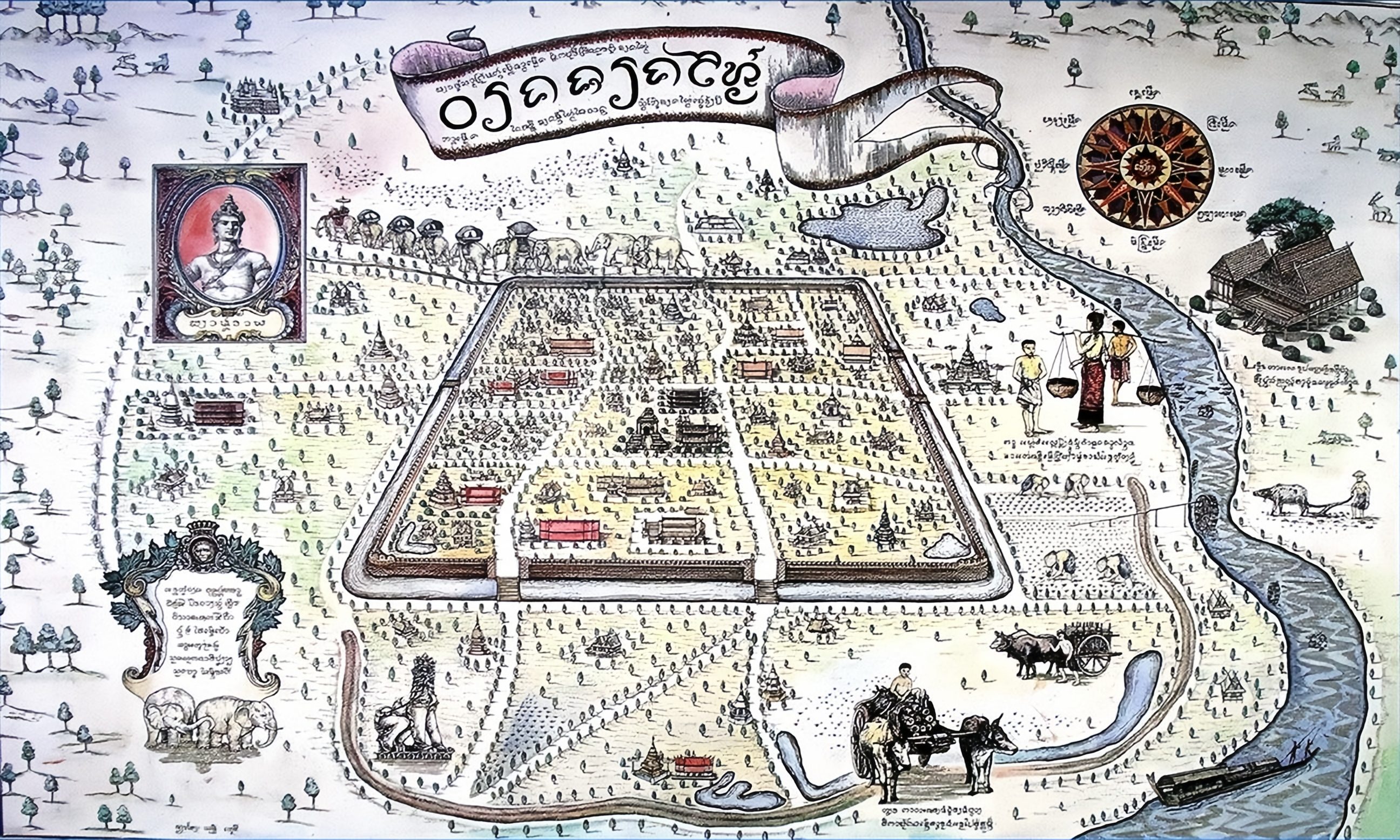
drawn by unknown
What it shows: The wall and the gates, and streets only where a street leads to something worth drawing.
An undated Lanna-era map of the walled city, with a portrait of a ruler at the left, the palace, the temples and the wall. It is a picture of a place rather than a survey of one: nothing on it is to scale and everything on it is where it belongs.
The record, with what was read off the sheet
The 1890 city map 1890
The sheet that names Chang Moi Road as newly built.
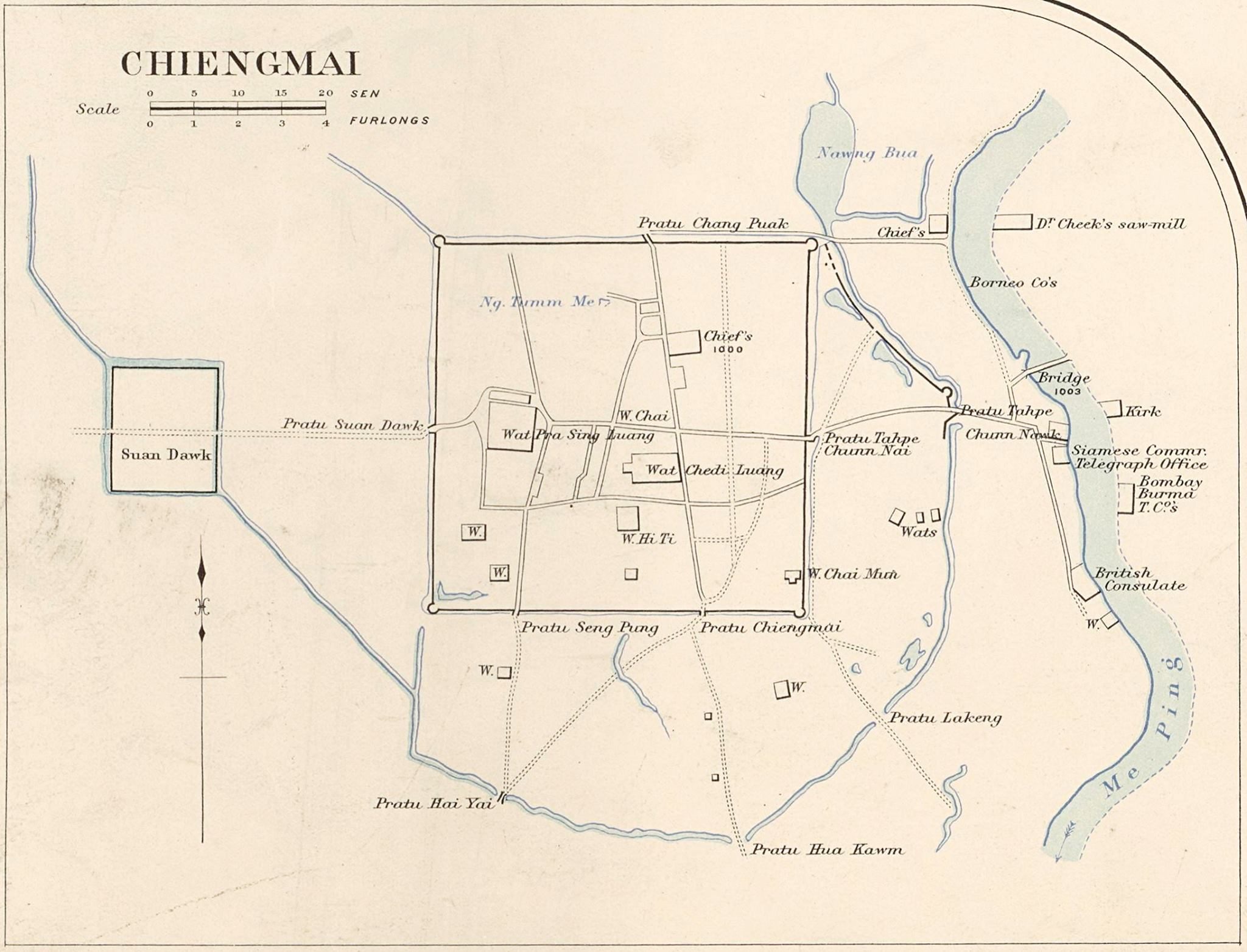
drawn by James McCarthy
What it shows: The moat square, the Ping, the earthen wall's line, and the first named streets outside the gates.
the file is titled 1890 and its own description says 1900; both are recorded and neither is resolved on this disk
A map of the city under the old spelling Chiengmai. Its own caption says a temple front faces east on the newly built Chang Moi Road, which dates that road to about this sheet and corroborates the chronicle: the outer gate and the earth bank came down between 1910 and 1915 so the street could run straight to the river, and the street was already being cut when this was drawn.
The record, with what was read off the sheet
The 1893 map for Inthawichayanon 1893
Two walls, drawn for a king who still had a court.
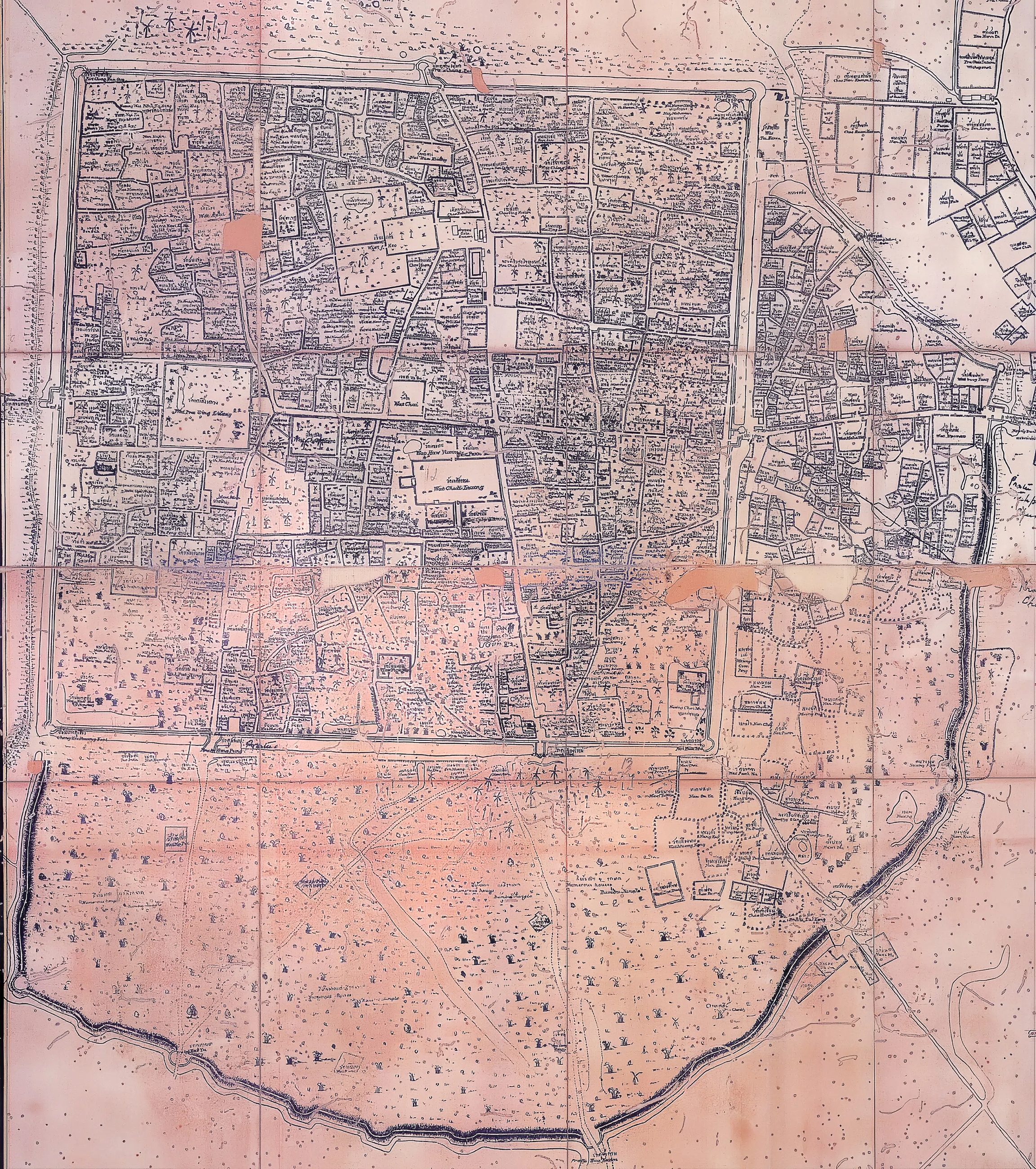
drawn by unknown, for the court of Chiang Mai
What it shows: The two walls together, which is the thing modern maps cannot show because one of them is gone.
Drawn for King Inthawichayanon, the last ruler before Siam's commissioners took the north in hand. It shows both walls: the inner brick square and the outer earthen bank curving round the trading quarter to the east.
The record, with what was read off the sheet
The 1931 city map 1931
Ten years after the railway, stamped by an insurance company.
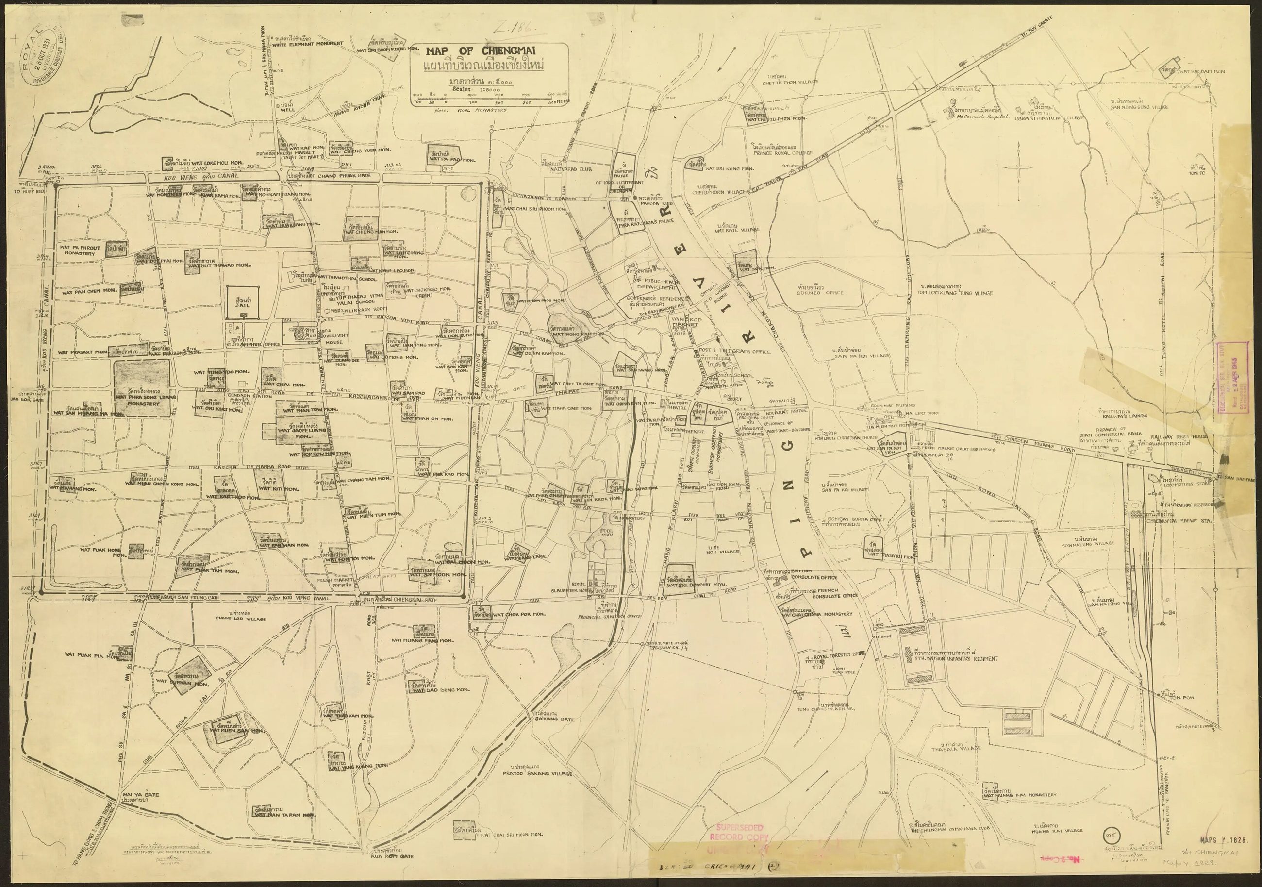
drawn by unknown; the sheet carries the stamp of the Royal Insurance Company Limited, 26 October 1931 · held stamped 26 October
What it shows: The east bank after the railway, seventeen years before the moat roads were cut.
A large city sheet carrying the stamp of the Royal Insurance Company, dated 26 October. It is the first map on this site made after the train arrived in 1921, and it shows what the train did: the east bank built up, Tha Phae Road the commercial spine, the streets between the square and the river filled in.
The record, with what was read off the sheet
The 1945 city map 1945
1:5,000, printed at the Survey of India, three years before the moat roads.
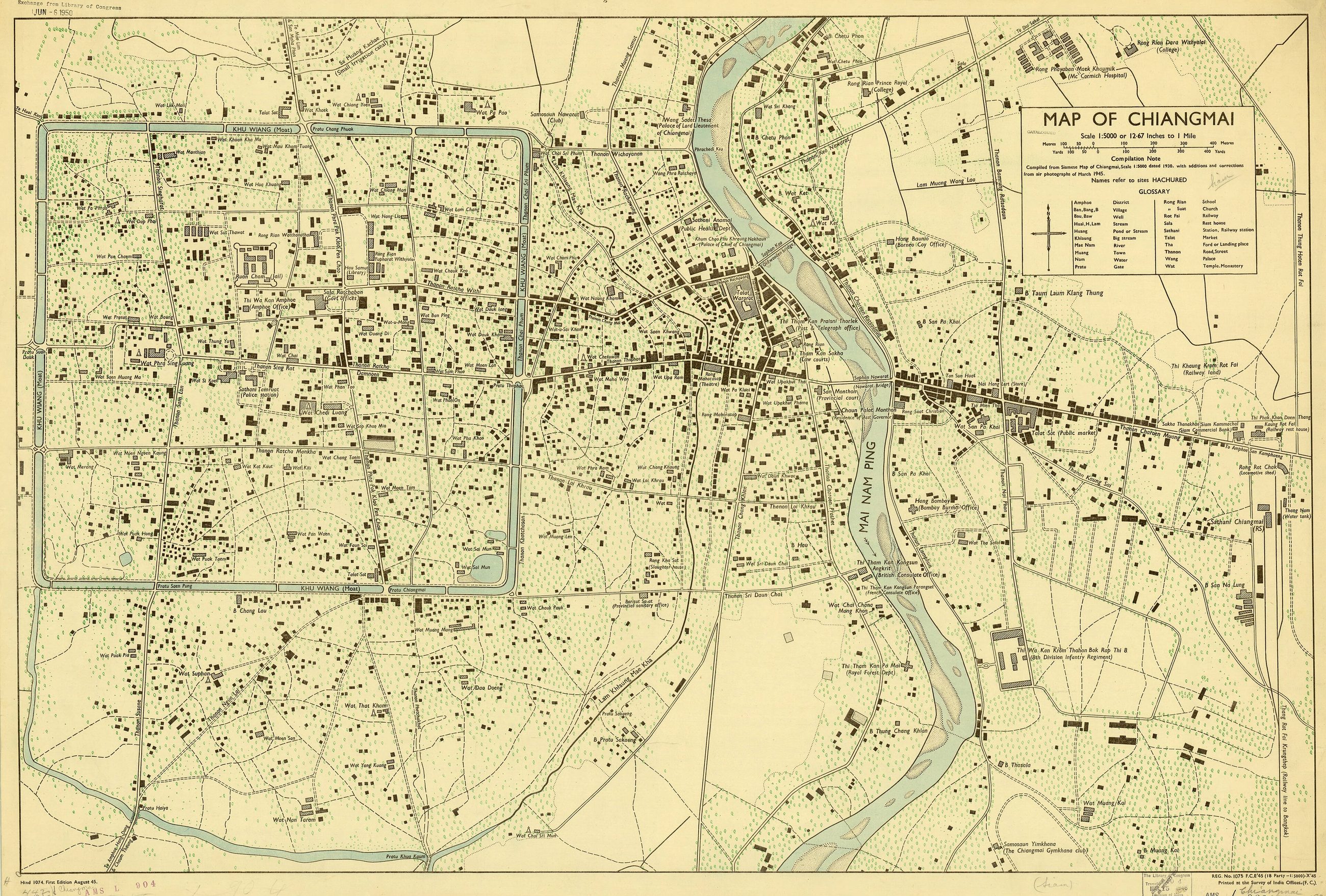
drawn by Survey of India · scale 1:5,000 · sheet AMS series L904 · held American Geographical Society · size the city, 57 × 87 cm
What it shows: The square in the last year it was a fortification rather than a roundabout.
first edition August 1945, compiled from a Siamese 1:5,000 sheet of 1930 and air photographs of March 1945
Printed at the Survey of India offices at 1:5,000, 57 by 87 cm, held by the American Geographical Society. It is the last map on this site that shows the old city before the municipality built the roads on both banks of the moat in 1948 and demolished stretches of the wall to do it.
The record, with what was read off the sheet
The Army Map Service sheet, NE 47-6 Chiang Mai 1954
1:250,000, series L509, and the first sheet here with a road classification on it.
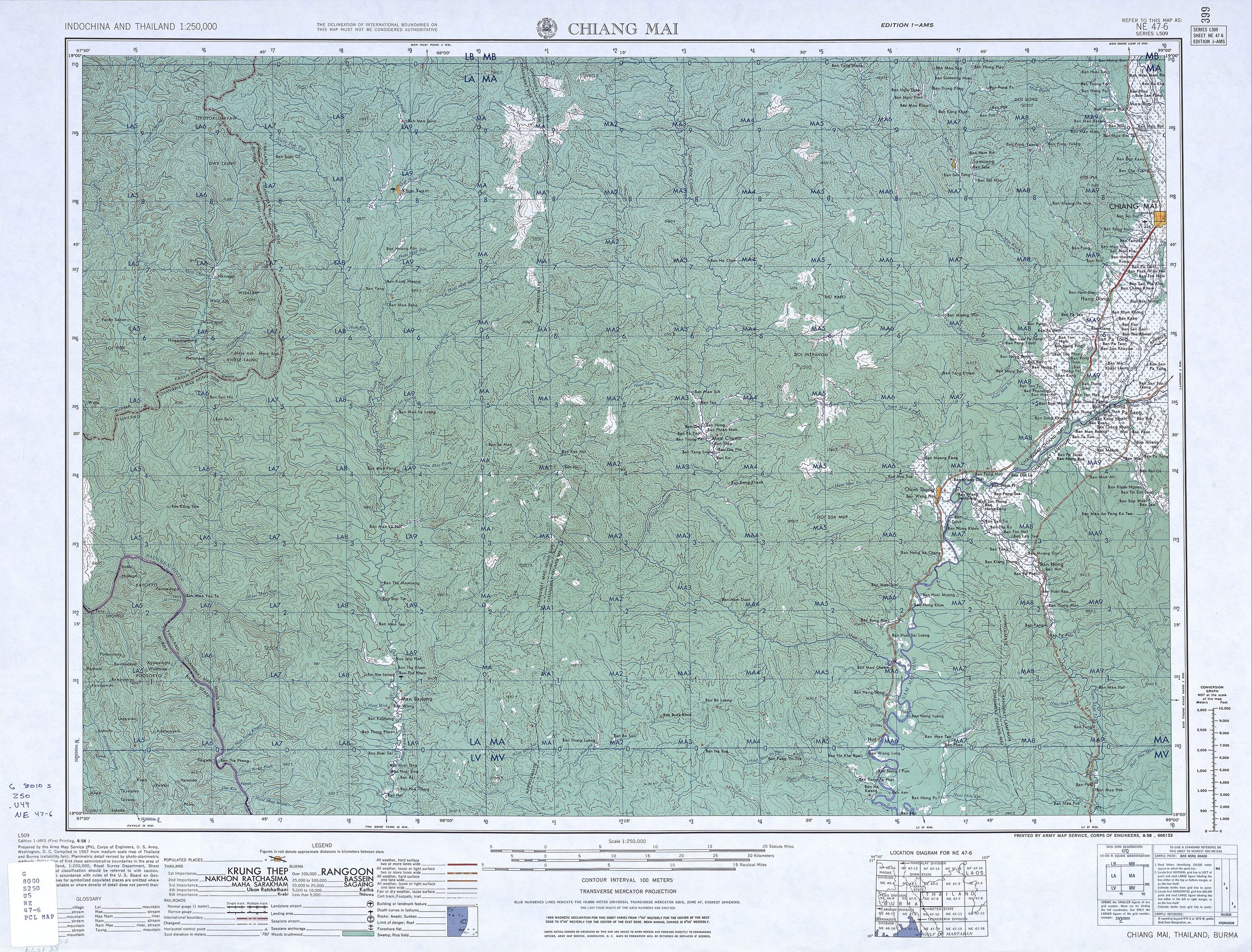
drawn by US Army Map Service · scale 1:250,000 · sheet NE 47-6, series L509
What it shows: The regional road network fifteen years before Route 11, classified by whether it was passable in the rains.
Sheet NE 47-6 of series L509, the US Army Map Service's 1:250,000 cover of Indochina and Thailand, from 1954. It carries the region at the moment before the Superhighway: roads classified by surface and weather, the Lamphun road as the main line south, and no ring of any kind around the city.
The record, with what was read off the sheet
The Army Map Service sheet, Ban Saraphi 1959
1:50,000, sheet 5455 II: the yang tree road, surveyed.
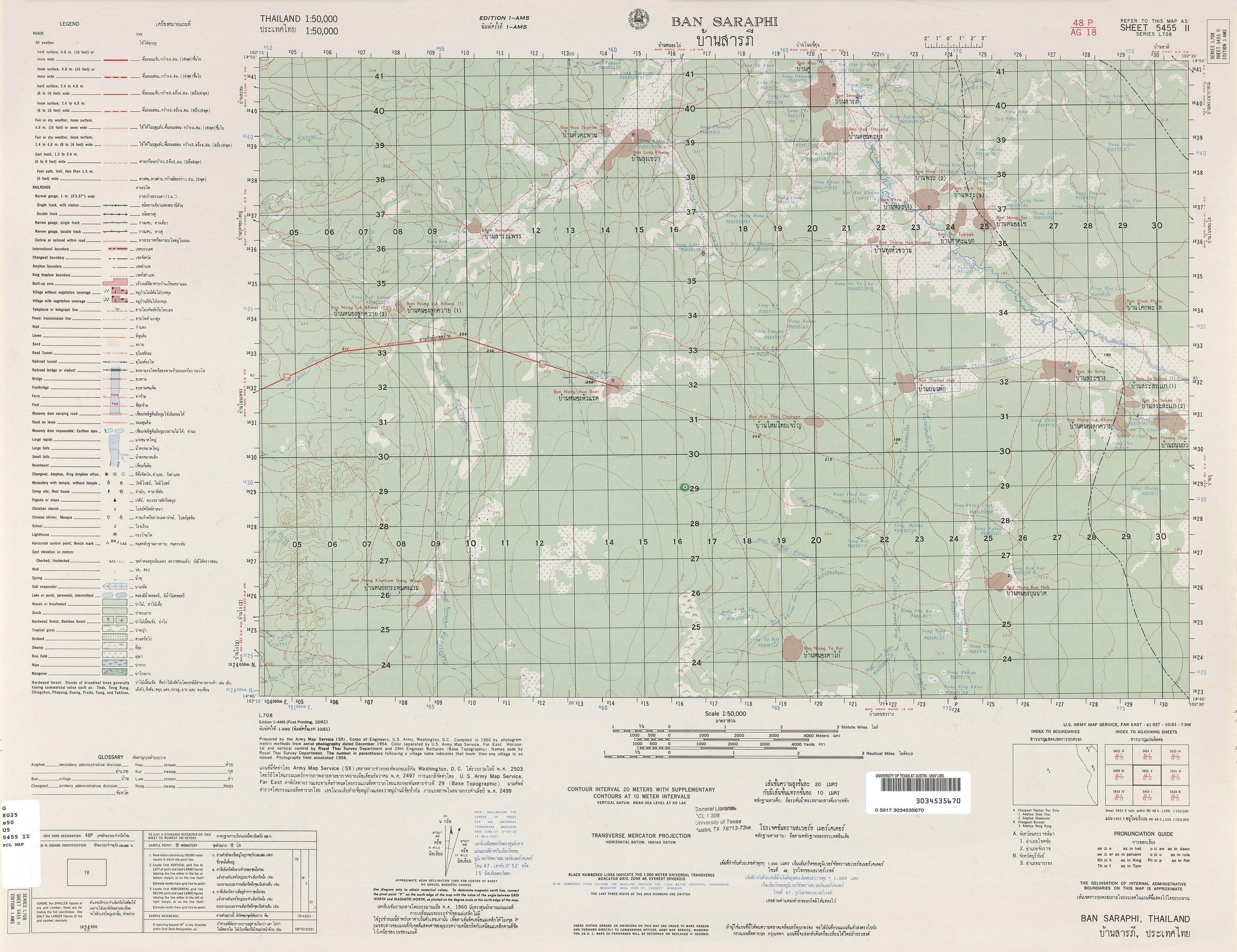
drawn by US Army Map Service · scale 1:50,000 · sheet 5455 II, series L708
What it shows: The Lamphun road and the fields around it at fifty-metre contours, before any ring reached this far south.
Sheet 5455 II of series L708, the 1:50,000 cover of Thailand, 1959. Saraphi is the district the Chiang Mai to Lamphun road runs through, and this is the sheet the yang trees are on, seventy-seven years after they were planted and ten years before the Superhighway took the Bangkok traffic off them.
The record, with what was read off the sheet
The country
Loubère's Siam, 1693 1693
The oldest sheet here, and there is no Chiang Mai on it.
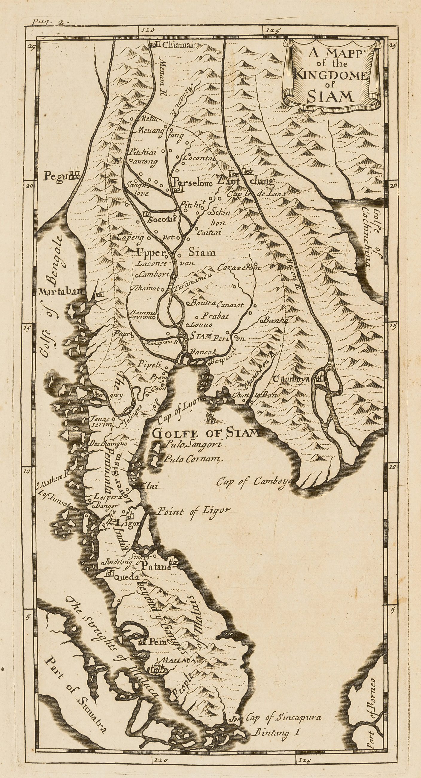
drawn by Simon de la Loubère
What it shows: Rivers, and the roads not at all.
Simon de la Loubère's map of Siam, English edition, from the account of his embassy to Ayutthaya. Lanna was not Siam in 1693 and the north of this map is guesswork. It is here as the base line: the first European drawing of the kingdom this city would later be governed from.
The record, with what was read off the sheet
Bock's route to the north, 1881 1881
A Norwegian walked to Chiang Saen and drew the way he went.
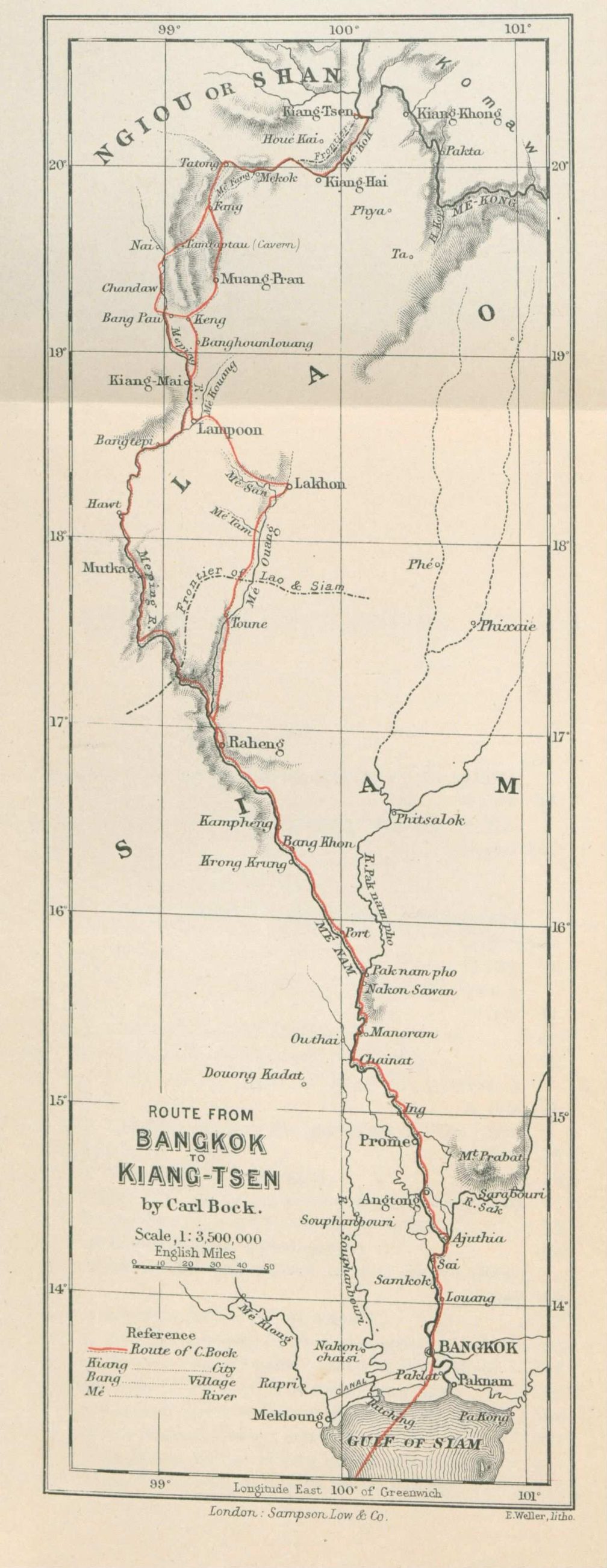
drawn by Carl Bock · held Bibliothèque nationale de France
What it shows: One route, drawn as a strip, with nothing either side of it.
the journey was 1881; the book and its plates were published in 1884
Carl Bock's map of the route from Bangkok to Chiang Saen, from Through Upper Siam and Lao, his narrative of a journey of exploration published in 1884. The sheet is a strip: it is long and narrow because a route is long and narrow, and everything either side of it is blank because he did not go there.
The record, with what was read off the sheet
Pavie's itineraries, 1880–1884 1884
Not a map of roads. A map of one man's routes, which is what a road was.
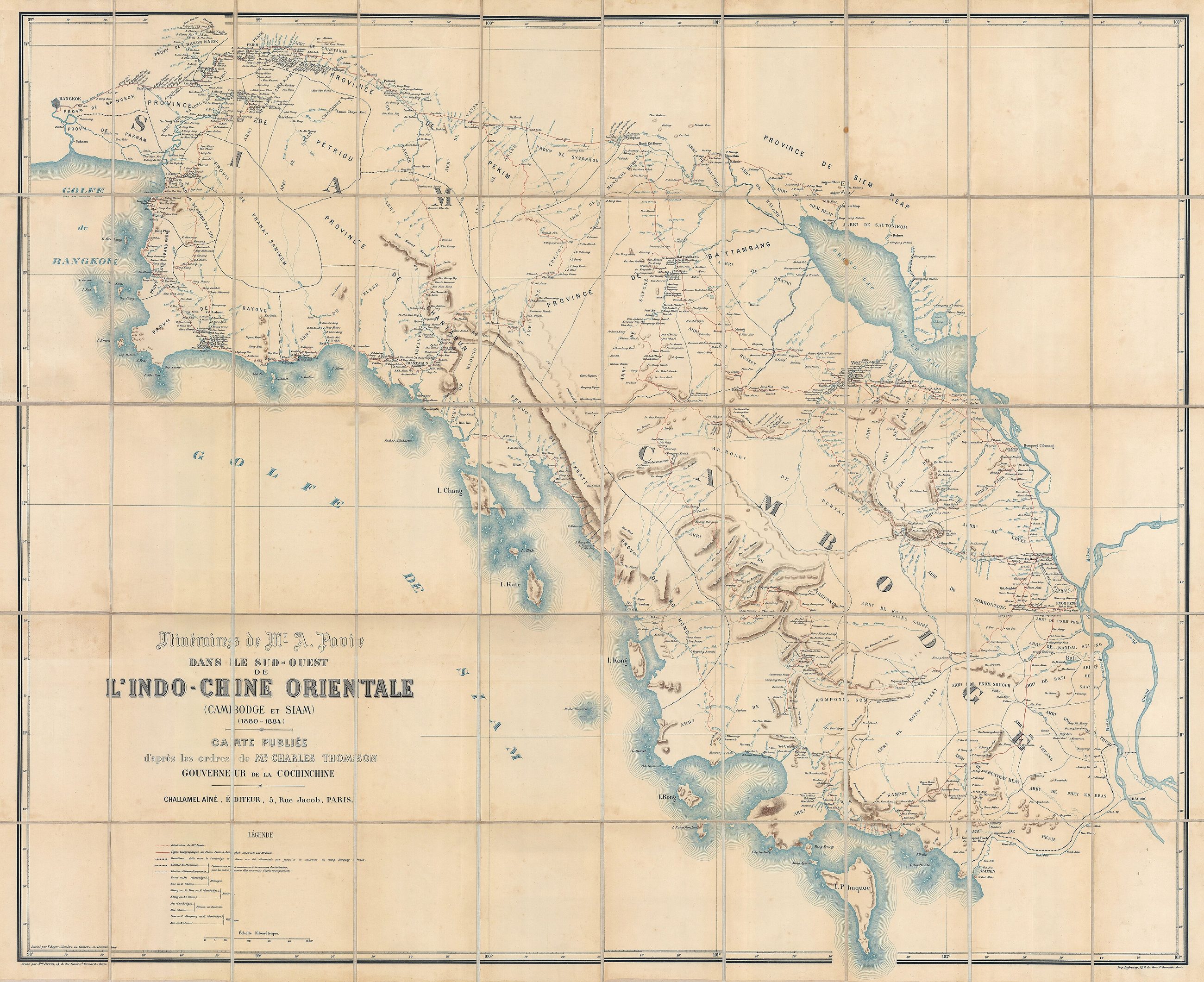
drawn by Auguste Pavie · size 106 × 130 cm
What it shows: The routes as travelled, with the places strung along them.
Auguste Pavie's own traverses through Cambodia and Siam, 1880 to 1884, drawn at 106 by 130 cm. A French colonial officer walked and floated the routes and the lines on the sheet are where he went. The distinction between a route and a road had not been made yet, because there was nothing in the north that would survive a rainy season.
The record, with what was read off the sheet
McCarthy's Siam, 1888 1888
The first survey, made for Siam by an Englishman, with the north still a dependency.
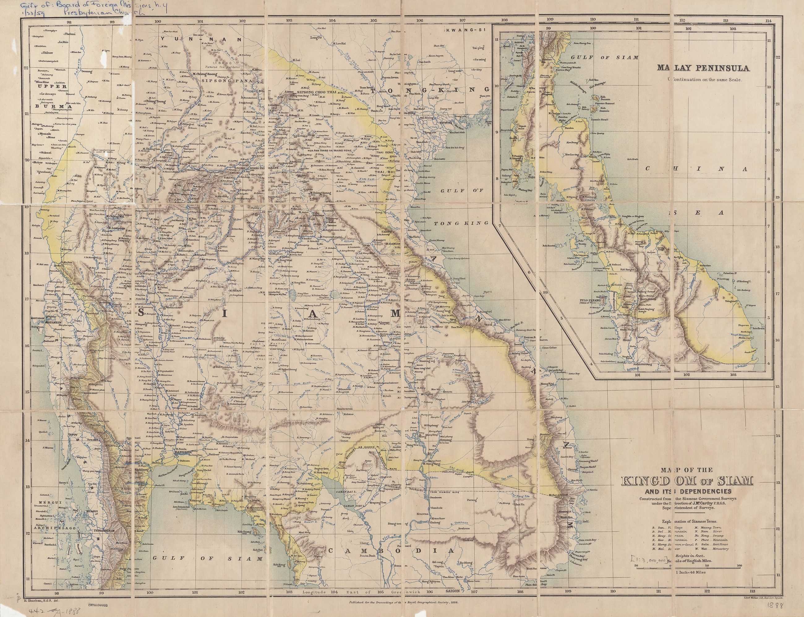
drawn by James McCarthy, for the Siamese government
What it shows: The north as a dependency, and the survey lines that made it a province.
James McCarthy's map of the kingdom and its dependencies, from government surveys under his direction. Its dependencies are Laos, part of Cambodia and the northern Shan States. Chiang Mai appears on it as a place in a tributary state, six years after the yang trees went in on the Lamphun road.
The record, with what was read off the sheet
McCarthy's Siam, 1900 1900
Twelve years later, ordered by a prince, and the north is inside the line.
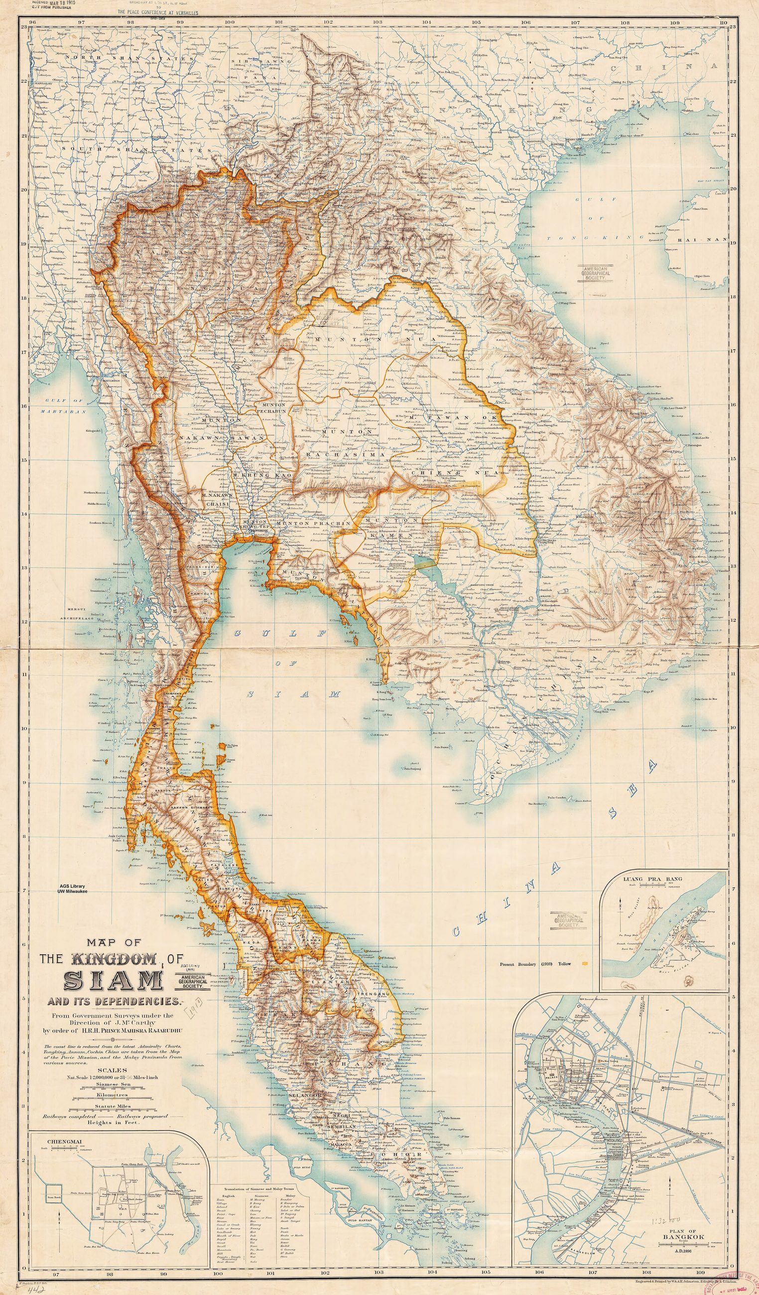
drawn by James McCarthy, by order of a Siamese prince
What it shows: A province where a tributary state had been, and roads beginning to be worth drawing.
The second McCarthy sheet, from government surveys by order of a Siamese prince. Between this map and the last one the north stopped being a dependency and became Monthon Phayap, administered by a high commissioner from Bangkok. The commissioner of that decade is the one who had the yang trees planted and the Hang Dong road built.
The record, with what was read off the sheet
The Siam State Railways map, 1930 1930
Nine years after the train reached Chiang Mai, at 1:2,500,000.
![Sujet : Chemins de fer
Siam, Royaume de -- Chemins de fer
Échelle(s) : 1:2 500 000
Couverture : Monde
Langue : anglais
Éditeur : [s.n.]](/roads/images/map-railways-1930/map-railways-1930-map-of-the-siam-state-railways-btv1b53195599n.jpg)
drawn by Royal State Railway Department of Siam · scale 1:2,500,000 · held Bibliothèque nationale de France
What it shows: The line that made the east bank of the Ping the commercial side of the city.
The state railway's own network map at 1:2,500,000, in English, showing the northern line complete to Chiang Mai. The train had arrived on 1 January 1921 through the Khun Tan tunnel, and this is the network as the railway wanted it seen nine years later.
The record, with what was read off the sheet
The Royal State Railways map, 1934 1934
The same network, renamed, the year the monk broke ground on the mountain.
![Sujet : Chemins de fer
Siam, Royaume de -- Chemins de fer
Échelle(s) : 1:2 500 000
Couverture : Monde
Langue : anglais
Éditeur : [s.n.]](/roads/images/map-railways-1934/map-railways-1934-map-of-the-royal-state-railways-of-siam-btv1b531955986.jpg)
drawn by Royal State Railway Department of Siam · scale 1:2,500,000 · held Bibliothèque nationale de France
What it shows: The state's idea of how you reach the north.
The 1934 edition of the railway network at the same scale, under the name Royal State Railways of Siam. It is the same year Kruba Srivichai broke ground on the road up Doi Suthep, which is a useful pairing: the state was laying steel and a congregation was laying laterite, in the same province, in the same twelve months.
The record, with what was read off the sheet
The first national map, 1939 1939
The Royal Thai Survey Department, in Thai, and the country has a new name on it.
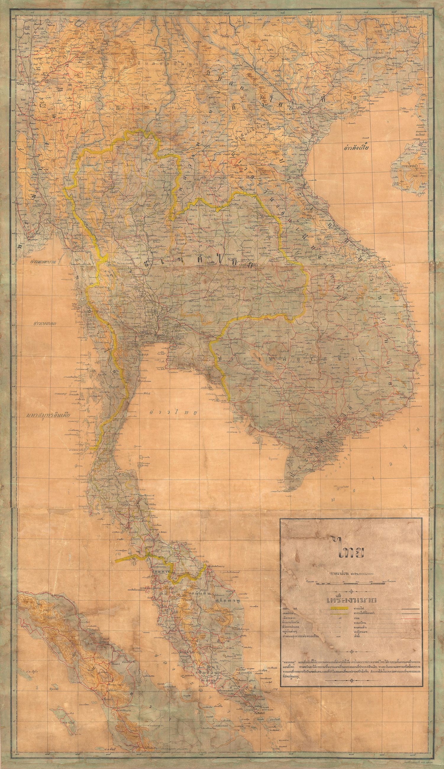
drawn by Royal Thai Survey Department
What it shows: The country under its new name, with the north drawn as part of it and not beside it.
A Royal Thai Survey Department map of mainland Southeast Asia, described as the first national map of Thailand and the first to carry the new name. Siam became Thailand in 1939, and the sheet is the state drawing itself as it wanted to be read.
The record, with what was read off the sheet
The War Office sheet, 1946 1946
London's map of Siam the year after the war, 85 cm across.
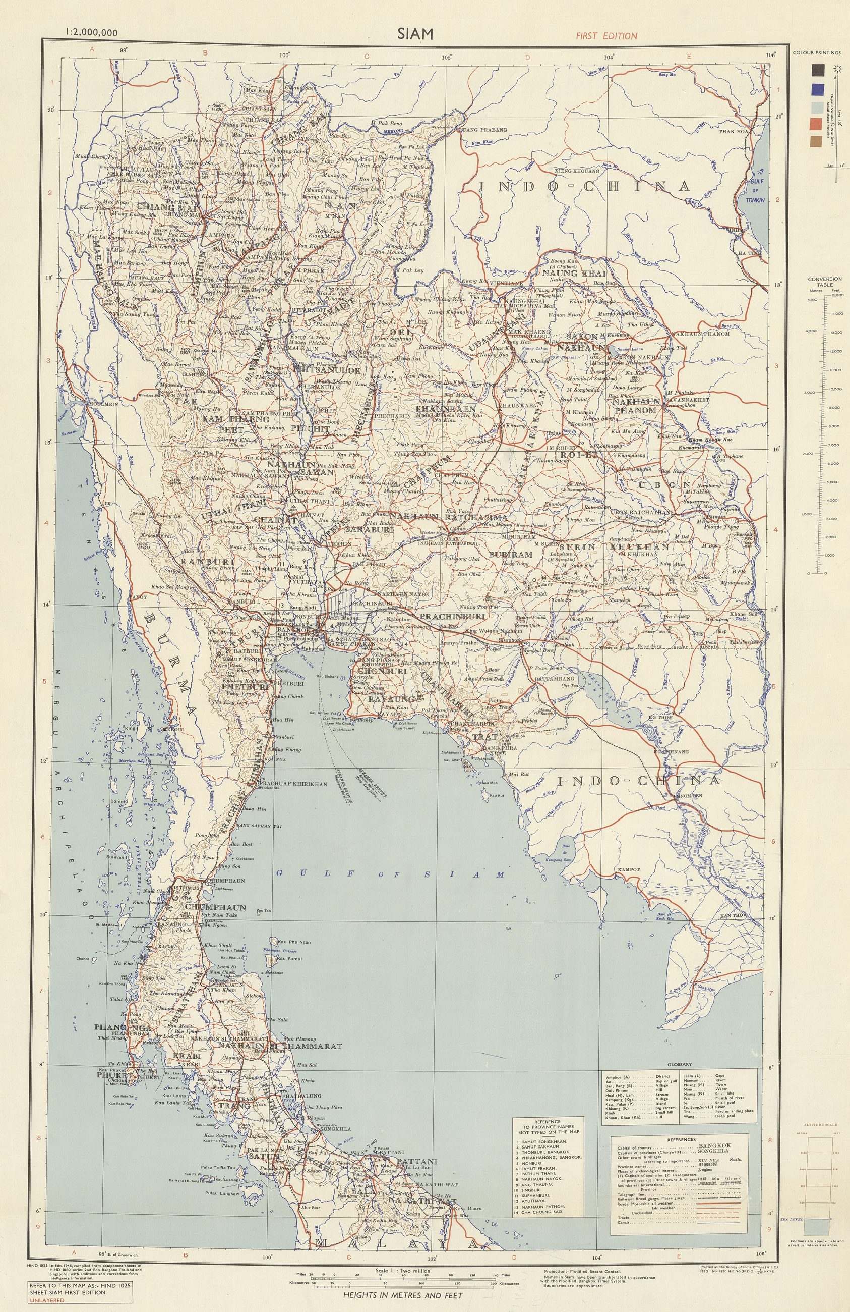
drawn by War Office, London · size 85 cm across
What it shows: The country as the Allies had it, at the moment the roads were about to be built.
A coloured map of Siam by the War Office in London, the year after the war and two years before the moat roads. Wartime and immediately post-war mapping of this country is unusually good because armies needed it, and it is the reason a 1945 city sheet at 1:5,000 exists at all.
The record, with what was read off the sheet
The Shell wall map, about 1958 c. 1958
A petrol company's bilingual map, and the roads are the point of it.
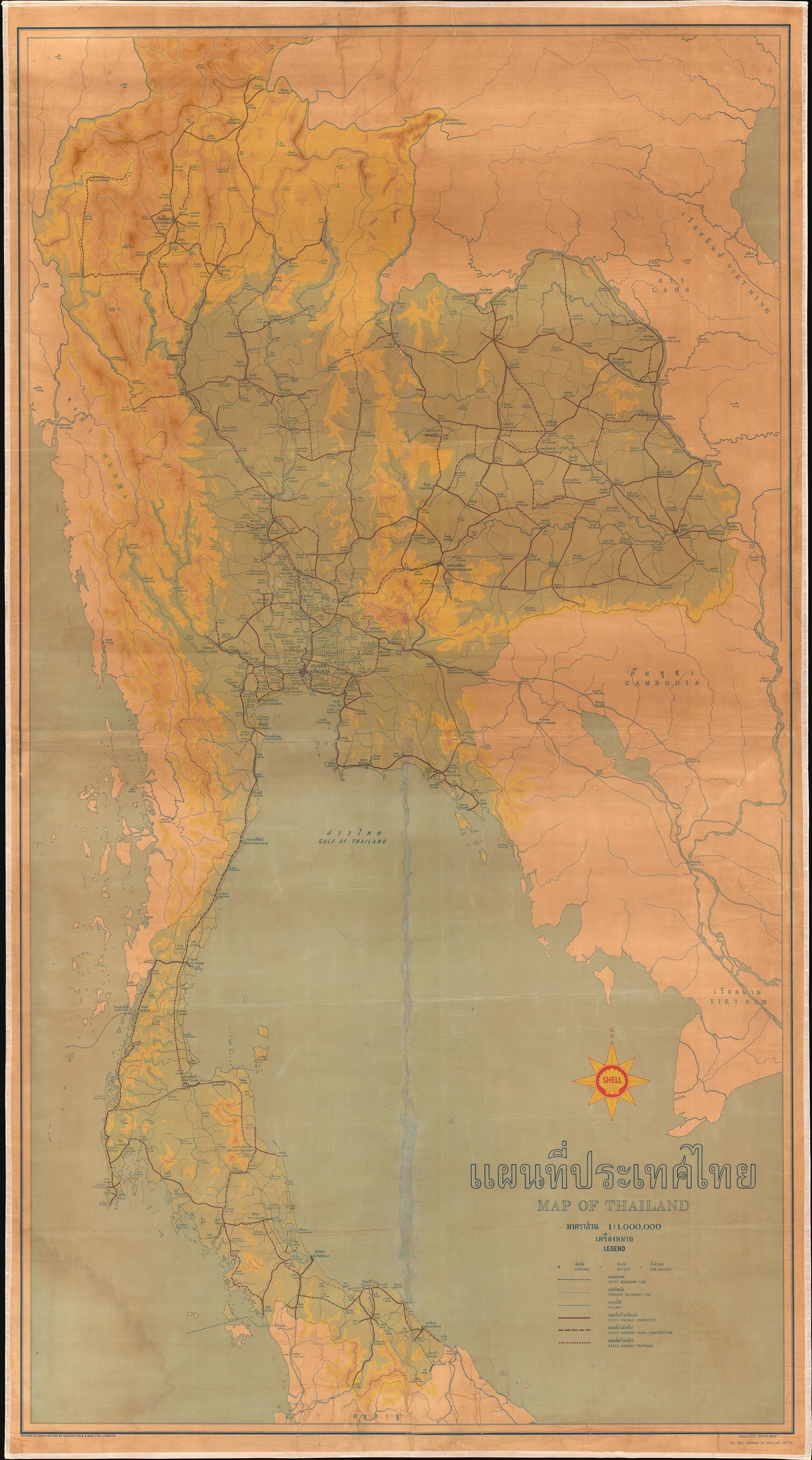
drawn by Shell Company of Thailand
What it shows: The national road network a decade before the Superhighway, drawn by someone with a reason to get it right.
undated; about 1958 by the publisher's own description
A large bilingual wall map of Thailand issued by Shell, undated but about 1958: highways, railways, towns and topography. A petrol company draws the roads because the roads are the business, which makes an oil-company map the best road map of its decade.
The record, with what was read off the sheet
Where they came from
Every sheet here is on Wikimedia Commons under a free licence, and the author and licence sit under each one. The 1:250,000 and 1:50,000 sheets are US Army Map Service series L509 and L708, public domain, digitised by the Perry-Castañeda Library at the University of Texas. The two railway maps are from the Bibliothèque nationale de France. Nothing here was redrawn: they are the sheets, scanned.