ringThe moat loop
ถนนรอบคูเมือง · Thanon Rop Khu Mueang
6.54 km, two roads, one clockwise and one counter, since 1948.
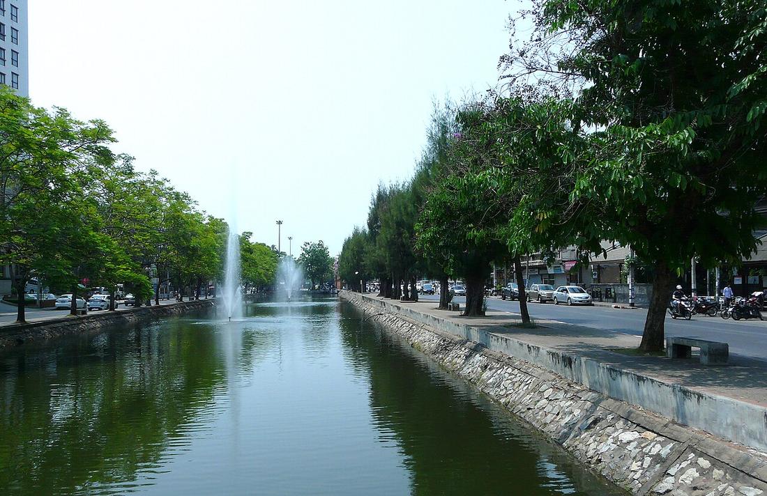 Hartmann Linge · CC BY-SA 4.0
18.7883, 98.9855 · OpenStreetMap · The map
What it is
The pair of one-way roads on the two banks of the moat: the outer bank runs clockwise, the inner counter-clockwise, so that the square is a roundabout 6.54 km round. The municipality built the roads in 1948, demolishing stretches of the wall to do it. The year the one-way system began is not on this disk.
The long version
Inference — the loop is the city's first ring and its smallest, and the only one that is not a bypass: it does not take traffic round the centre, it takes traffic round the centre's edge and lets it in at the gates and the corners. A driver who misses a turn drives the whole square again. Everyone who has lived here has done it.
The story page argues what the loop did to the old city; the measurements page counts what is inside it.
Connected to
- The moat The water.
- Why the moat runs one way The argument.
- The grid score, zone by zone What is inside.
- Ring 1, the Superhighway ring The next ring out.
Named here by
- Ratchadamnoen Road The other one-way system.
- Chang Phueak Gate On the ring.
- Chiang Mai Gate On the ring.
- Hua Lin Corner The ring turns here.
- Katam Corner The ring turns here.
- Ku Hueang Corner The ring turns here.
- Si Phum Corner The ring turns here.
- Suan Dok Gate On the ring.
- Suan Prung Gate On the ring.
- Tha Phae Gate The ring it opens onto.
- 1900–1950 — Siam and the railway Built 1948.
- The 1945 city map Built three years later.
- How much of the road runs one way The loop.
- The municipality's roads, counted by the municipality Municipal roads.
- คู khu The roads on it.
- What this site does not have No year for the one-way.
- Why the moat runs one way The loop.
- The moat The roads on its banks.
Where each claim comes from
| Field | Tier | Source | Note |
|---|---|---|---|
| default | cited | คูเมืองเชียงใหม่ / กำแพงเมืองเชียงใหม่ — Wikipedia (th) | |
| text_th | inference | written in Thai by this project, in the northern register where it fits; not machine-translated |
Sources
- คูเมืองเชียงใหม่ / กำแพงเมืองเชียงใหม่ — Wikipedia (th)
- Chiang Mai City history timeline — City Heritage Centre, Chiang Mai Municipality
cited Cited — a named source, linked · harvested Harvested — fetched from an open dataset, with its licence · tradition Tradition — general knowledge of the tradition, hedged · inference Inference — this project's own reasoning from the above · field Field — someone stood there