mapPavie's itineraries, 1880–1884
เส้นทางเดินทางของปาวี 2423–2427
Not a map of roads. A map of one man's routes, which is what a road was.
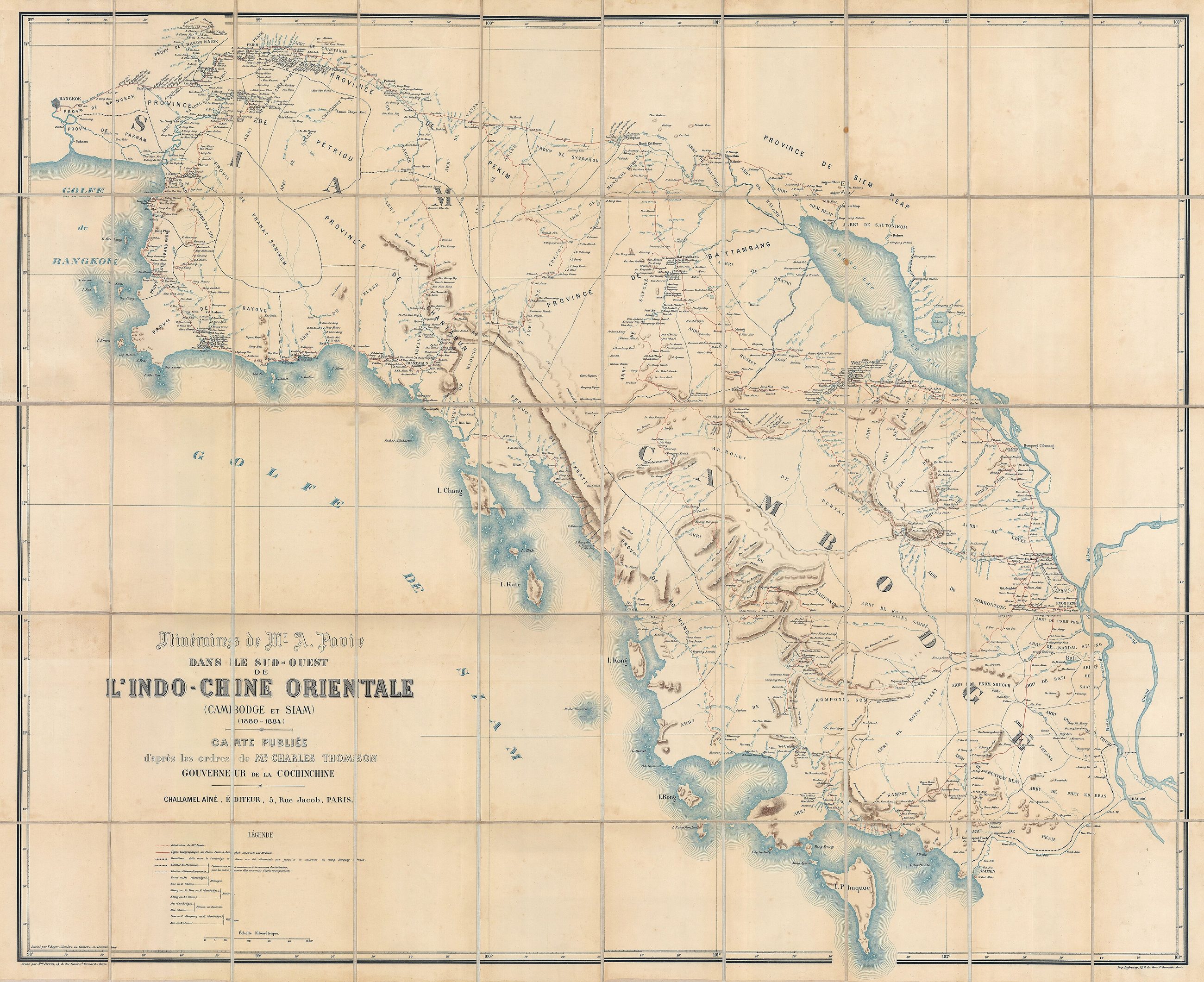 Auguste Jean-Marie Pavie (1847 - 1925) · Public domain
What it is
Auguste Pavie's own traverses through Cambodia and Siam, 1880 to 1884, drawn at 106 by 130 cm. A French colonial officer walked and floated the routes and the lines on the sheet are where he went. The distinction between a route and a road had not been made yet, because there was nothing in the north that would survive a rainy season.
Connected to
- McCarthy's Siam, 1888 The survey that followed.
- 1796–1900 — Kawila's rebuilding Its era.
Named here by
- Bock's route to the north, 1881 The same decade, the same problem.
- Loubère's Siam, 1693 Where the land routes start.
Where each claim comes from
| Field | Tier | Source | Note |
|---|---|---|---|
| default | cited | Wikimedia Commons — the map and photograph files, each with its own licence on its file page — Wikimedia Commons | |
| text_th | inference | written in Thai by this project, in the northern register where it fits; not machine-translated |
Sources
- Wikimedia Commons — the map and photograph files, each with its own licence on its file page — Wikimedia Commons
cited Cited — a named source, linked · harvested Harvested — fetched from an open dataset, with its licence · tradition Tradition — general knowledge of the tradition, hedged · inference Inference — this project's own reasoning from the above · field Field — someone stood there