storyWhat a road does to an old city
ถนนทำอะไรกับเมืองเก่า
Measured, not argued: the square of 1296 against the rings around it.
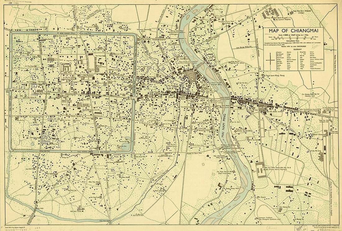 Survey of India Offices · Public domain
What it is
The site's spine. It takes every drivable way OpenStreetMap holds for the city and asks the same questions of the square inside the moat and of each ring outside it: how many intersections per square kilometre, how many lanes end in a dead end, how long a block is, how strongly the streets keep to a grid, how much of the network runs one way, how many wats sit in each zone. The measurements page has the numbers; this page reads them.
The long version
The square is the best-connected neighbourhood in the city, and it is the oldest. The grid of 1296 was laid gate to gate on the cardinal directions, and seven centuries of infill have kept to it: the orientation measure on the measurements page shows the moat zone closest to a perfect grid of any zone, and the intersection density highest. A lane inside the moat comes out somewhere. Outside, in the rings, it does not: the dead-end share climbs ring by ring, because a hom out there is a shared driveway that stops at the last house.
Each ring was an edge that became a middle. The Superhighway of 1969 was a bypass; the 700 Years Road of 2006 was a bypass; Route 121 was a bypass. The city grew past each in ten to fifteen years, and the bypass became a street with traffic lights, which the department then spent a decade digging under. Seven underpasses on ring two; three on ring one; five interchanges under tender on ring three. The pattern is not a failure of planning. It is what a ring road is for, and what it costs later.
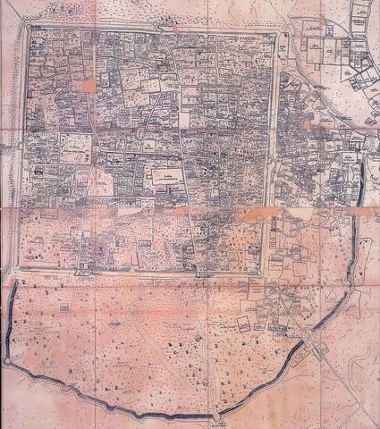
The old city paid in walls. 1910–15: Chang Moi Gate and its bank removed for a straight road to the river. 1948: the moat roads built and stretches of a registered monument demolished. The square that had been a fortification became a roundabout. Since then the direction has reversed: a 12 m height cap, a walking street from 2002, Ratchadamnoen one-way for pedestrians from 2021, a world-heritage nomination in 2026 whose file flags a tunnel under the old town as a conflict.
The roads grew by two thirds; the vehicles doubled. The thesis this rests on counted main-road kilometres from 36.5 to 60.3 between 1992 and 2003 and registered vehicles from 465,659 to 933,733. Mahidol Road, built as a two-lane bypass in 1972, counted 121,403 vehicles a day in 2025. Every road in this catalogue was built to relieve the one before it.
And the trees are the exception. The yang-na on the Lamphun road are alive partly because the Superhighway took the Bangkok traffic off them in 1969. One new road did an old one a favour; it is the only case here.
Inference — the whole page is inference from counted things, and the counts are printed beside it with the method.
Connected to
- The grid score, zone by zone The grid number.
- Dead ends, zone by zone The dead-end number.
- Intersections per square kilometre The density number.
- Roads versus vehicles, 1992 to 2003 The thesis number.
- The Yang Tree Road, Chiang Mai to Lamphun The exception.
- 1900–1950 — Siam and the railway When the walls went.
Named here by
- The 1945 city map The argument.
- The grid score, zone by zone Where the number is argued.
- Roads versus vehicles, 1992 to 2003 Where the number is used.
Where each claim comes from
| Field | Tier | Source | Note |
|---|---|---|---|
| default | inference | OpenStreetMap, via Overpass — OpenStreetMap contributors | |
| text_th | inference | written in Thai by this project, in the northern register where it fits; not machine-translated |
Sources
- OpenStreetMap, via Overpass — OpenStreetMap contributors
- Urban spatial order: street network orientation, configuration, and entropy — Geoff Boeing, Applied Network Science 4:67 (2019) — Applied Network Science
- การขยายตัวของเมืองเชียงใหม่ตามแนวถนน — วิทยานิพนธ์ภูมิศาสตร์ ม.เชียงใหม่ 2548, บทที่ 3 — Chiang Mai University Library
- Chiang Mai City history timeline — City Heritage Centre, Chiang Mai Municipality
- ถนนช้างม่อย — Wikipedia (th)
- ปริมาณจราจรเฉลี่ยต่อวันตลอดปี (AADT) — open data 2560–2568 — กรมทางหลวง Department of Highways
- The journey to becoming a UNESCO World Heritage city — Chiang Mai Citylife
cited Cited — a named source, linked · harvested Harvested — fetched from an open dataset, with its licence · tradition Tradition — general knowledge of the tradition, hedged · inference Inference — this project's own reasoning from the above · field Field — someone stood there